Airborne parcel delivery
ALAADy in final descent
© DLR
There are many places worldwide difficult to access on the road – for instance, islands or secluded villages. Time-critical goods such as urgently needed pharmaceuticals or spare parts must be flown in. This requires a fully equipped airport, a functioning flight control, and pilots. Autonomously flying cargo drones capable of automatic starting, flying, and landing are a significant simplification in this respect. The DLR project ALAADy (Automated Low Altitude Air DeliverY) is working on this issue. The drone flies on specially planned routes, avoiding inhabited regions to minimise the damage incurred with an emergency landing. If an emergency rescue helicopter crosses its path, the drone diverts early before the encounter. The basic prerequisites for autonomous flight are, of course, precise satellite navigation – for example, with the European Galileo system – and precise maps that are also based on satellite data.
© DLR
What if such an unmanned aircraft must land under difficult ambient conditions, for instance, on a ship, affected by wind and waves? That is also possible. Research is done with DLR’s superARTIS helicopter in the MaRPAS project.
What about unauthorised drones?
© esc Aerospace
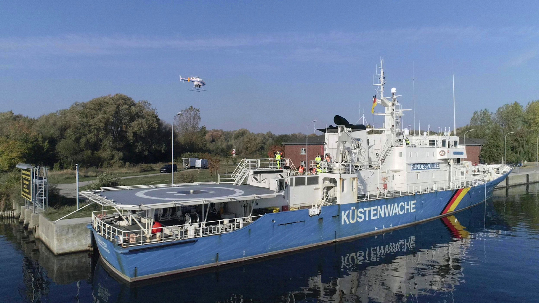
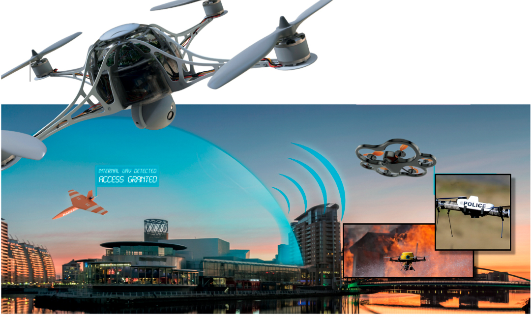
When many autonomous drones are underway in the future, the question of air traffic control arises. Human pilots know the rules and are in constant contact with flight control. That is different with drones. Those with malicious intent can start a drone at any place and fly it to any place. How can air traffic control and protection of the citizens work? With a virtual protective shield, gapless drone surveillance, and, in the future, maybe also with police drones. In the ESA project DroSecMa, the German company esc Aerospace, supported by DLR, developed protective measures. Space technologies play a key role since the protective systems are controlled by satellite communication in a fail-safe manner. Moreover, emergency personnel or police drones need satellite navigation for determining the intercept course.

One size larger: UFO
© DLR
Unmanned Freight Operations – UFO for short – could be the future of cargo aircraft. Instead of a crew on board, a crew on the ground, consisting of pilots and air traffic controllers, takes over “remote control”. This crew is capable of controlling and monitoring many aircraft, since for most of the time, aircraft are flying via autopilot anyway. For the control to function, the position of the aircraft must be known at any time – via satellite navigation. In addition, a stable and safe connection between the aircraft and the ground station is required, which is identified through satellite communication. In the DLR project UFO, scenarios were defined for implementation, and new supporting systems, processes, and technologies, both for air traffic controllers and pilots, were developed and tested. Control and management of unmanned aerial vehicles like satellites and probes is a typical space technology in which DLR has a wealth of experience.
Three examples:
- A small aircraft could fly components back and forth between two plant locations
- A large cargo aircraft is reconstructed to enable “remote control”
- In humanitarian operations, large quantities of relief supplies must be transported fast, always using the same way of transport
The researchers have also considered how autonomous aircraft could fit in the mixed operations at the airport. Many scenarios have already been simulated by DLR with the German Air Navigation Services – thus, this technology is no longer a vision for the remote future. The implementation is merely a matter of time.
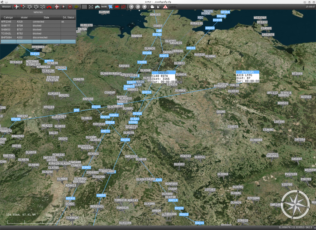
City-ATM: airspace management for drones and air taxis
© DLR
The air traffic control is in charge for flights at high altitudes, the tower for flights in the vicinity of the airports. In lower airspace, aircraft fly by visual flight rules. What if air traffic gets denser in this airspace, for example, through automated cargo drones, or when air taxis fly over the cities? How does an automated drone recognise that an emergency rescue helicopter will cross its path shortly “with blue light flashing” and has “right of way”? How do drones know of a major fire that must on no account be traversed? In this case, a new kind of airspace management is required. DLR’s City-ATM project is working on this issue. In this project, the requirements concerning a new communication, navigation, and surveillance infrastructure are analysed, evaluated, and checked in flight tests. One example is a major fire: a drone of a public authority detects smoke during a patrol flight – a major fire. A no-fly zone is established immediately around the fire source and uploaded into the cloud, from where all automated drones continuously get current “traffic news” so that they can make a detour around this area.
City-ATM is embedded in the major European SESAR (Single European Sky ATM Research) Programme, an initiative originated by the European Commission and EUROCONTROL for standardisation, harmonisation, and synchronisation of the services within the scope of the European air traffic management.
MasterUAS: safer drone operations
© DLR
How does one teach drones to recognise an emergency rescue helicopter and to get out of its way? To this end, an automated “Detect & Avoid” technology is required that is capable of viewing “around the corner” – for example, around a high-rise building or a mountain’s crest. This technology is not available as yet. For this reason, such a system is being developed in the DLR project MasterUAS (Multisensor system with “Detect & Avoid” for safe integration of UAVs in air traffic). Simulations are an important part in this development: it is not possible to test any such system in real airspace – which is why a simulated drone is sent into real air traffic situations, however, only on the computer. To this end, DLR has its own air traffic simulator. The project is funded by the Federal Ministry for Economic Affairs and Climate Action (BMWK) within the scope of the third call of the National Aeronautical Research Programme (LuFo V-3).