From space, the weather
can be monitored better –
in order to predict it better
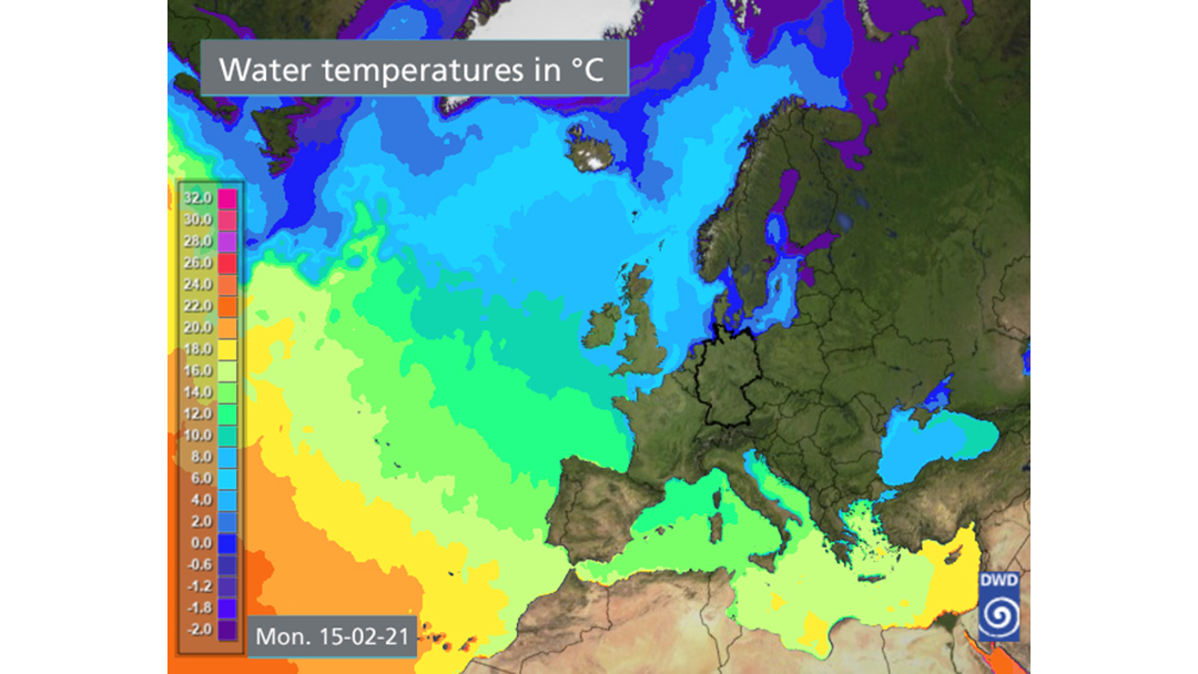
Before there were weather satellites, meteorologists had to laboriously collect and evaluate data such as air pressure and temperature from weather stations on the ground, every now and then complemented by data from weather balloons. Ever since weather satellites have existed, the weather forecasts have significantly improved. Now it is easier for meteorologists to acquire the data and to observe the complete weather in 3D around the world, at all air layers and also on the ground and above the sea. Assisted by numerical models and supercomputers, today weather forecasts are made from this data.
© Deutscher Wetterdienst
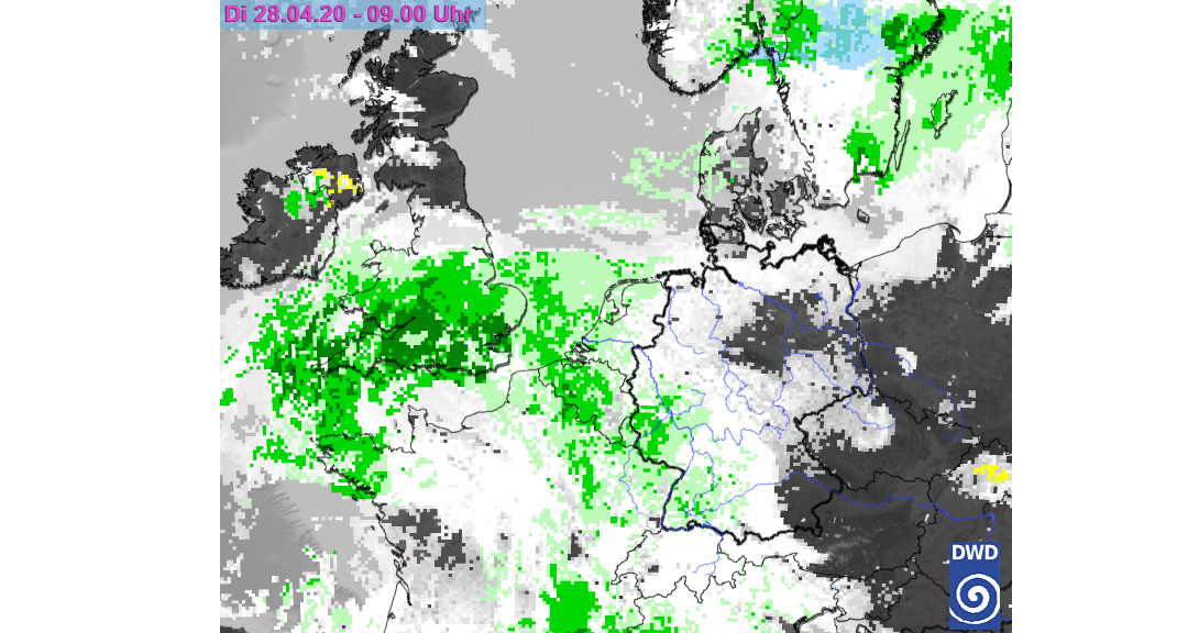
What does a weather satellite see?
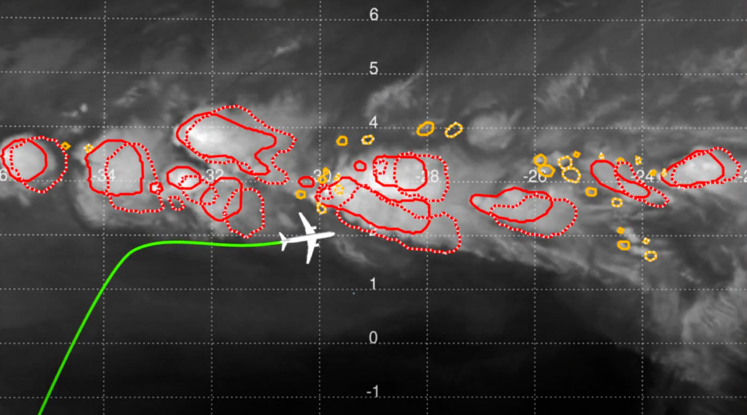
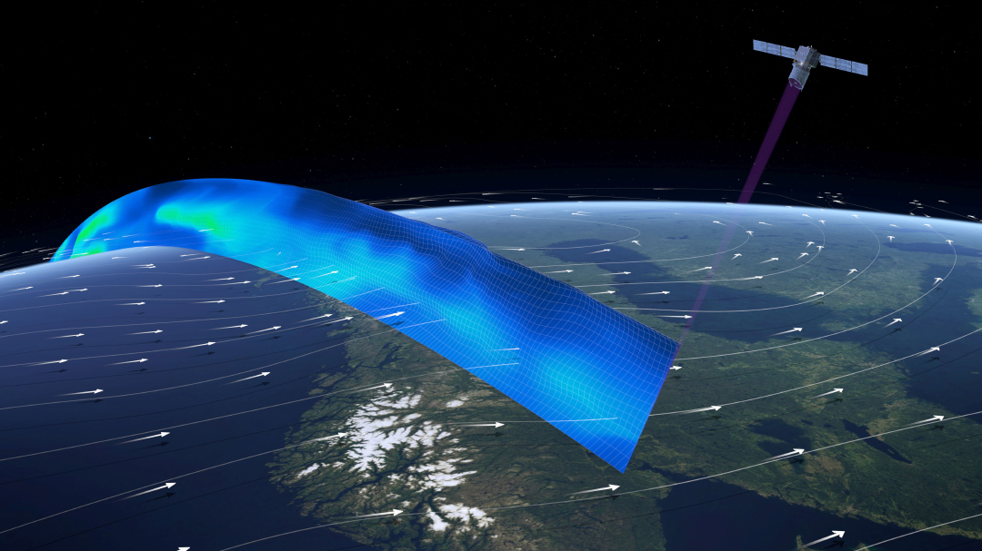
In the 1960s, weather satellites were only capable of seeing clouds – using normal cameras. However, as early as the 1970s, they can see considerably more than the visible light (reflected sun radiation), namely infrared radiation (heat) – by day and night. Meteorologists combine the data to determine the distribution of water steam in the atmosphere, to examine clouds, or to determine the distribution of temperatures. In addition, today radar systems are on board the satellite, which, for example, observe sea waves – to derive wind speed and direction from the data.
© Deutscher Wetterdienst
Meteosat and MetOp: the weather satellites for Europe
Today, a network of weather satellites is covering the entire Earth. There are two types of satellites complementing each other: geostationary ones and polar-orbiting ones. The most important weather satellites for us are from the Meteosat and MetOp series. The Meteosat satellites – currently the second generation – are geostationary, i.e. like TV satellites always in the same place viewed from Earth, at an altitude of 35,786 kilometres above the equator at the Gulf of Guinea. This is why they always see the same section: Europe, Africa and Eastern Atlantic, however, they are almost blind in the polar regions. With each generation, more and more precise weather data are acquired; today, the Earth’s surface is captured with a resolution of one kilometre max. in twelve vision channels and sent to Earth every five minutes; starting 2022, the resolution will increase to up to 0.5 kilometres via up to 16 channels. Important supplements are the polar-orbiting MetOp satellites that are orbiting the Earth at an altitude of 820 kilometres only. They are scanning the entire surface of the Earth within days.

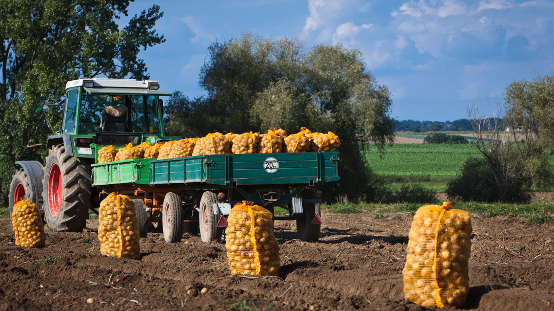
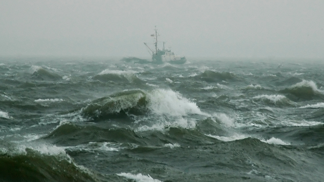
Better forecasts benefit us all
© ARD-aktuell
© Lisa F. Young/fotolia.com
© Martin Schlecht/fotolia.com
© DLR
© Matthias Krüttgen/fotolia.com
© Jörg Hackemann/fotolia.com
© ESA/ATG medialab
© DLR CC-BY 3.0
Live: this is how the wind blows worldwide at present
© Cameron Beccario, earth.nullschool.net


The forecast: in high resolution, frequently updated
Increasingly earlier
From when can we forecast what?
7-10 days in advance: large scale weather developments and trends
5-6 days in advance: today, more reliable than a 24-hour forecast in 1968
2-4 days in advance: forecasts and early warnings (Germany)
12-72 hours in advance: forecasts and warnings (German, German Länder)
12-0 hours in advance: short-term forecasts, severe weather warnings (German Länder, districts)
Increasingly more reliable
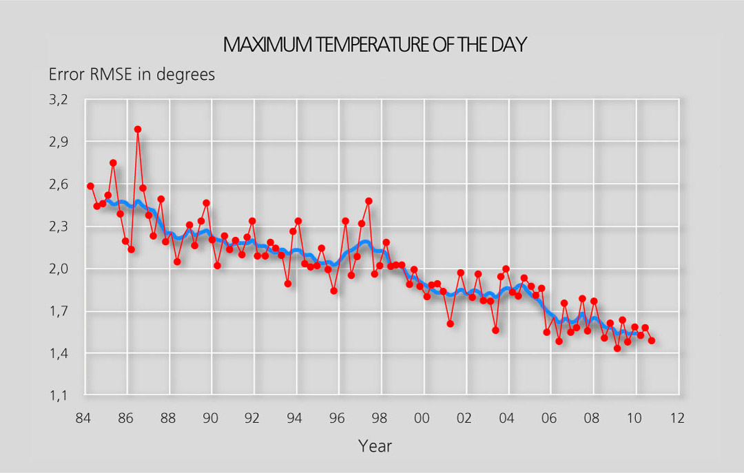
Due to ever decreasing errors and deviations. At the end of 1960, the forecasts for the peak temperature of the next day missed the actual value by 5 degrees once or twice a month. Today that happens at most once or twice a year. On average, today the inaccuracy is plus/minus 1.5 degrees – clearly answering the question of whether we will need a jumper tomorrow or not. So, the forecasts have become ten times more reliable since then.
© Deutscher Wetterdienst (DWD)
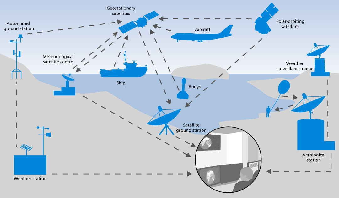
As recently as 150 years ago, country sayings were the only source for “weather forecasts”. Today, the weather forecast is high-tech science. Measurement and observation data from all over the world, from the ground, the seas, the air, and from weather satellites, are transmitted to large datacentres where supercomputers featuring the capacity of 30,000 personal computers and more calculate the weather for the next days for any place in the world.
Global, regional, and local
For weather forecasts, so-called models are used. They simulate the atmosphere of the Earth and all its changes. The models deployed by the “Deutsche Wetterdienst” (DWD) are named ICON and COSMO. A fine-meshed virtual grid network with a mesh aperture of about 13 kilometres encompasses the Earth, from the ground to an altitude of up to 75 kilometres. All weather parameters are calculated for all 265 million grid network points – up to seven or ten days in advance. This takes the DWD supercomputer one hour only.
Locally even finer
For forecasts regarding Germany, the grid network is even finer. The mesh aperture is currently 2.8 kilometres only. With the ensemble technology, calculating 20 slightly modified model variants and more in parallel, improved, detailed forecasts for the next 27 hours are possible. They are calculated eight times a day and are one of the foundations for weather and severe weather warnings by the DWD.
The European weather satellites –
geostationary and polar-orbiting
The first generation of Meteosat
The geostationary satellites Meteosat-1 to 7 (in space since 1977) delivered data every half an hour, at a resolution of 6.25 megapixels in the visible range. A surface of 2.5 x 2.5 kilometres is depicted as one pixel. The last one of these satellites was decommissioned in 2017, after 20 years of service.
To take a sharp image from a distance of about 36,000 kilometres, a tripod would be needed. Impossible in space though. This is why image stabilisation is different: the satellites look like a drum and are rotating a hundred times per minute around their own axis like a gyroscope. With each revolution, a new band of the Earth is captured.
Contrary to a digital camera, the image is not taken all at once by a chip through a lens but captured line by line with a radiometer, by means of a telescope featuring a focal length of 3.65 metres.
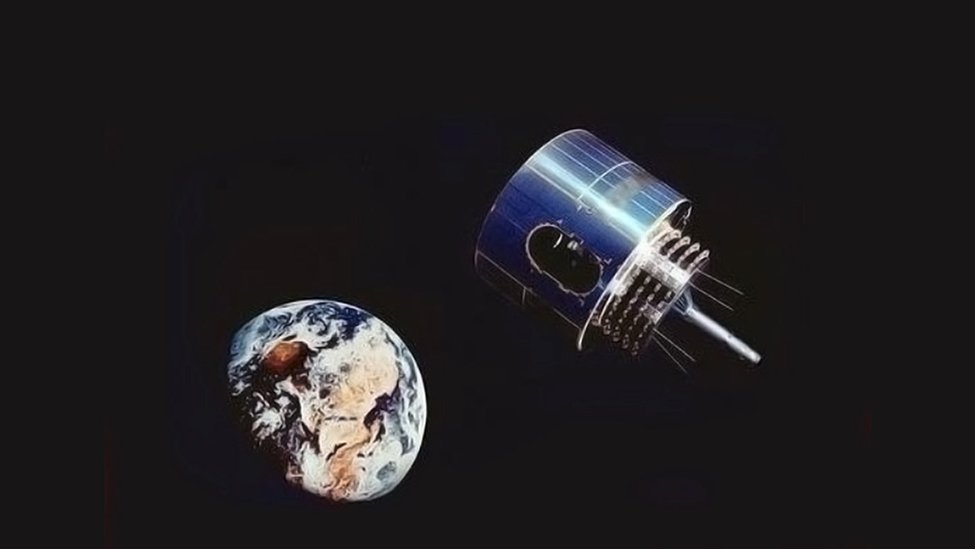
© NASA
The second, current generation (Meteosat Second Generation)
Meteosat-8 to 11, currently in operation today, are sending twice as often, with 20 times more details. Currently, an image (better: data) with a resolution of 124 megapixels is sent every 15 minutes – one megapixel equals 1 kilometre x 1 kilometre – a thunder cell can be detected from space this way. The image even consists of twelve single images since the satellite captures twelve frequency ranges separately, with the first generation, this was only three. The data is radioed to Earth with three Mbit/s.
There is also a spare satellite in orbit, which is sending an image every five minutes, however, only covering a small sector of Europe (our latitude). This is very helpful for tracking thunderstorms.
© Eumetsat
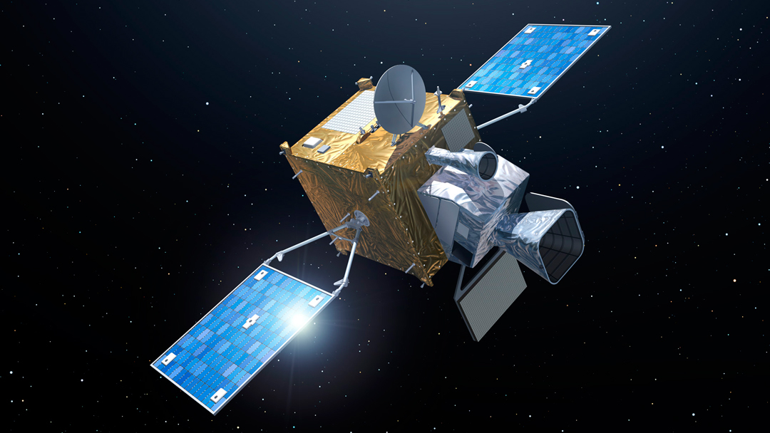
The third Meteosat generation (Meteosat Third Generation)
Instead of having the shape of a drum, future satellites will be box-shaped – the image stabilisation will then be achieved by a built-in 3-axis system. Advantage: the sensors are always aligned towards the Earth thus enabling numerous new measurements. This is supposed to be an enormous progress for weather forecasts and warnings:
- For the first time, a geostationary satellite will be capable of detecting how air temperature, wind speeds, and humidity are distributed over the layers of the atmosphere.
- A lightning detector can recognise thunderstorms, and another instrument detects atmospheric trace substances.
- The resolution is intended to get four times better: 496 megapixels, i.e. one pixel for 500 metres x 500 metres.
- The data is radioed to Earth with 60 Mbit/s – 20 times faster.
Presumably from 2022 onwards, these satellites (with a minimum service life of 15 years) will send overall images every ten minutes, partial views even every two and a half minutes – and all that in 16 frequency bands (instead of 12 before).
© ESA–P. Carril
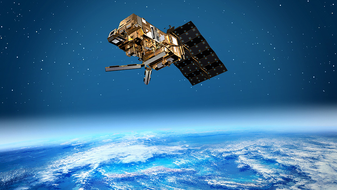
More precise weather forecasts with MetOp (Meteorological Operational Satellite)
Reliably forecasting the weather on the weekend already on Tuesday? This has been possible since 2006. Three MetOp satellites (the second generation will follow in 2023) complement the Meteosat satellites and deliver essential data for the numeric weather forecast, on the one hand enabling a better weather forecast for tomorrow, on the other hand medium-term weather forecasts as well as long-term climate and environmental research. They are extremely important, since they capture one quarter of the data meteorologists use in Europe. They orbit the Earth in a polar orbit and “scan” the Earth almost completely within one day – from a distance of about 800 kilometres instead of 35,800 kilometres like the Meteosat satellites. Every region in the world can be closely monitored once a day for approx. 15 minutes. The USA operates satellites with partly the same characteristics. The data are shared, since more data considerably improve the weather forecast. All over the world.
© ESA
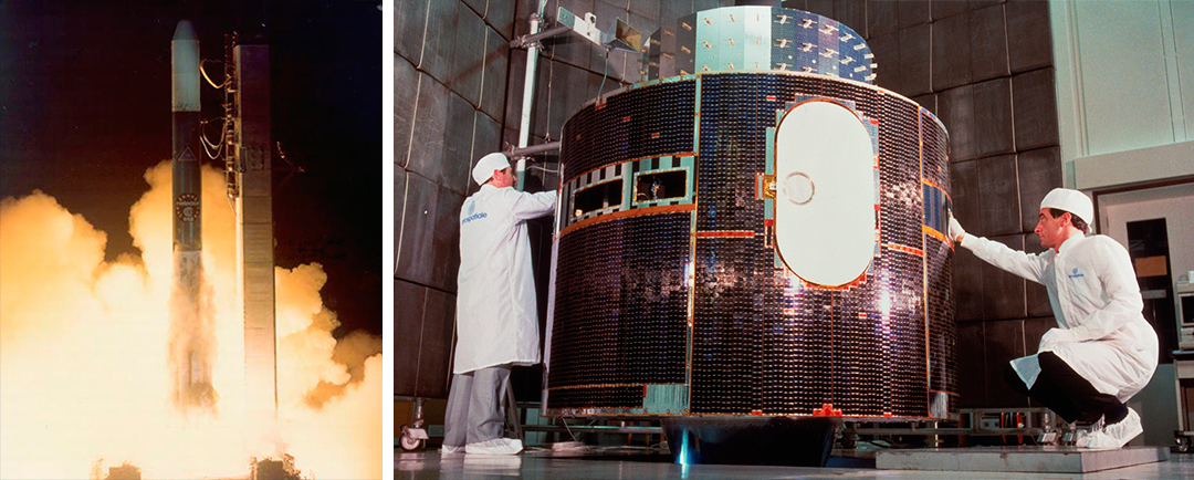
Image on the left: © NASA, image on the right: © ESA
The history of weather satellites
- 1960: First TV camera on the Tiros satellite in Earth orbit
- 1961: For the first time, reception of satellite images at the „Deutscher Wetterdienst“ and thus worldwide gapless monitoring of cloud coverage
- 1977: The first satellite of the Meteosat series is launched into an Earth orbit by ESA
- 1989: Launch of Meteosat-4
- 2002: The second generation starts operations with Meteosat-8. Now twelve channels are available for weather observation for the first time.
- 2005: Now Meteosat-5 is capable of receiving data from the new tsunami warning system and transmitting it to the ground station
- 2005: Meteosat-9 is launched
- 2006: The launch of MetOp-A – the satellite observes the weather proceedings by means of 13 instruments from an altitude of 820 kilometres
- 2012: Launch of MetOp-B
- 2015: The fourth and last satellite of the second Meteosat generation is launched into space from the space port in Kourou (French-Guiana).
- 2018: Launch of MetOp-C
- 2022: Launch of the third Meteosat generation
- 2023: Launch of the second MetOp generation