Agriculture with
the view from above
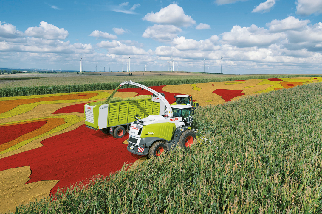
How satellite data ensure better yields
The Earth is supposed to nourish a continuously increasing number of people. At the same time, there is a growing conscience and the wish for “healthy” food, sustainably and environmentally friendly cultivated and harvested. Fertiliser and pest control are supposed to be used sparingly or better: not to be used at all – but this in turn will reduce the yields. A dilemma?
No, since there are some other options for optimising yields without stressing the soils beyond all measures: the control of irrigation and drainage, growth monitoring, and the increasingly sparing, more precise use of fertilisers, for example. Or bringing in the yield with a precision down to one metre.
Earth observation via satellites renders that possible and delivers data, images, and information to farmers helping them to make more economical use of their land. In addition, research is conducted on how agriculture can function anywhere – even in space. This enables agriculture in new places, without additional land consumption.

© DLR
© CLAAS
© DLR in cooperation with TH Deggendorf/CIS GmbH
© EOMAP GmbH & Co. KG; AGRO-DE Projekt
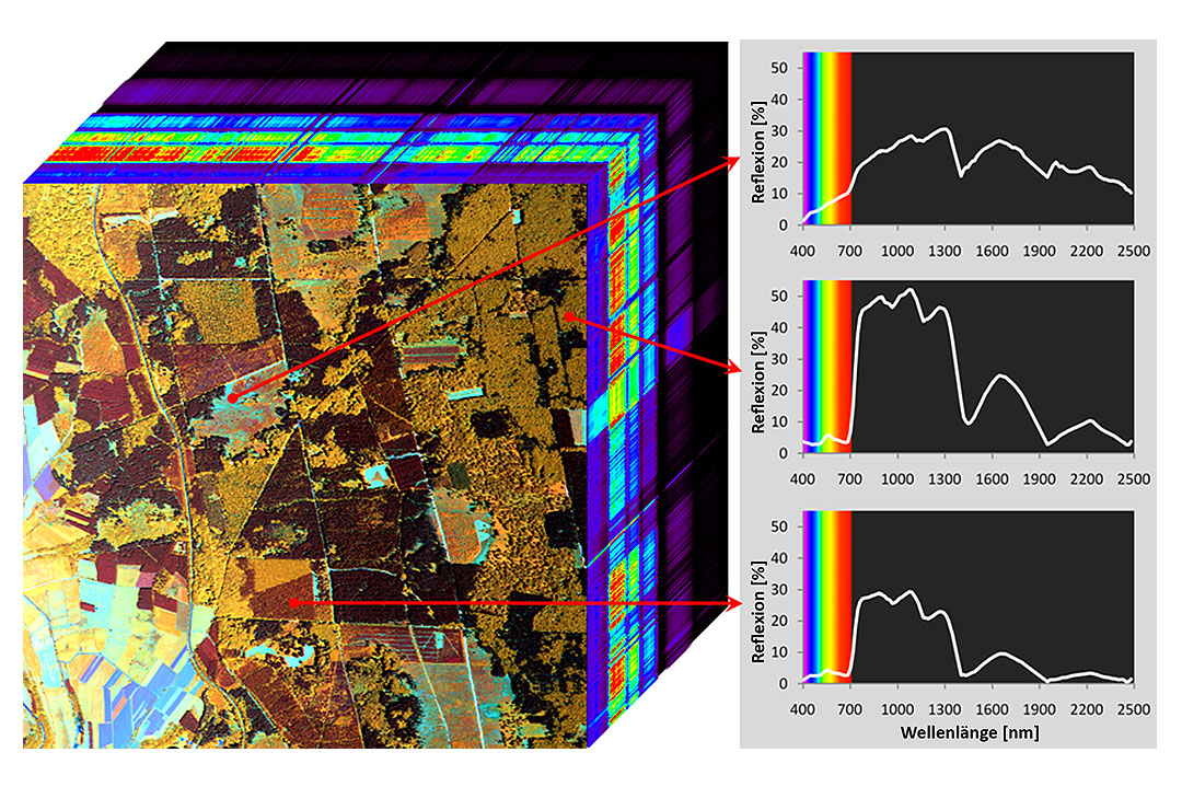
How plants feel: So-called “hyperspectral” images elucidate biochemical and biophysical parameters of plant growth. For example, they make the chlorophyll and water content visible. The German satellite EnMAP will acquire such data from space in future. This enables improved field crop classification, better yield forecasts, and a more precise control of plant growth.
© Dr. Henning Buddenbaum
How does rice grow? On which surfaces does rice grow faster? In which places would more or less fertilisation be needed? Where is cultivation not worthwhile? The growth of rice plants can be monitored by the DLR satellite mission TanDEM-X – with a precision in the centimetre range.
© DLR
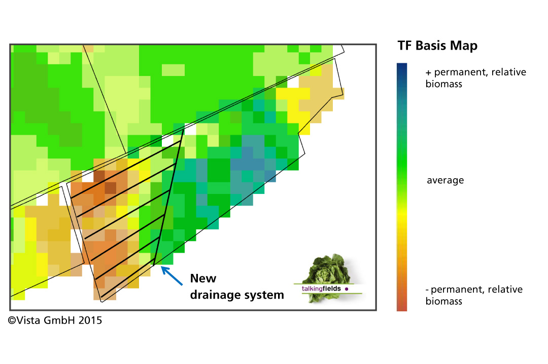
© Vista GmbH
From agriculture to farming in space
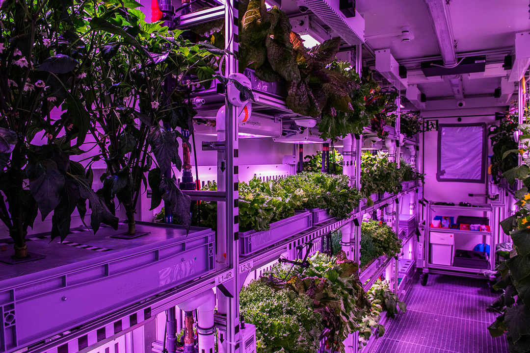
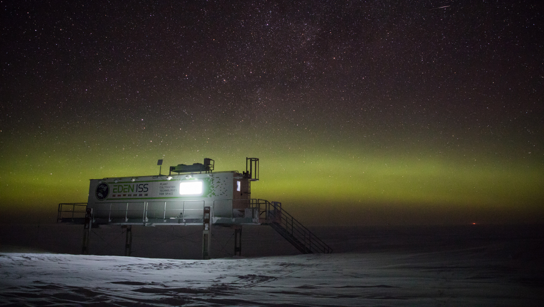
How much nutrition can be yielded on 12.5 square metres within nine and a half months? In an ordinary greenhouse: 400 kilogrammes of tomatoes. And in the Antarctic, in dark winter? Without sunlight? With artificial light only and with energy consumption being as low as possible? Even there, an astonishing 268 kilogrammes of cucumbers, salad and tomatoes are feasible. This is proven by the DLR project EDEN-ISS at the Antarctic station Neumayer III of the Alfred Wegener Institute, where the plants grow in a nutrient solution without soil. For the overwintering team at the station, fresh vegetables were a mood elevator since normally fresh food is not served there. Something like that will someday also apply to inhabitants of the Moon. They will have to cultivate foodstuff themselves on site to avoid dependency on deliveries from Earth.
© Alfred-Wegener-Institut/Esther Horvath
For them, DLR developed a foldable 30-square metre version of this greenhouse. It is sufficiently small to be carried as payload on a launcher. This new type of foodstuff cultivation in self-sufficient containers is also very interesting for other cold regions as well as for deserts and cities.
© Hanno Müller
Methane: highly harmful, underexplored
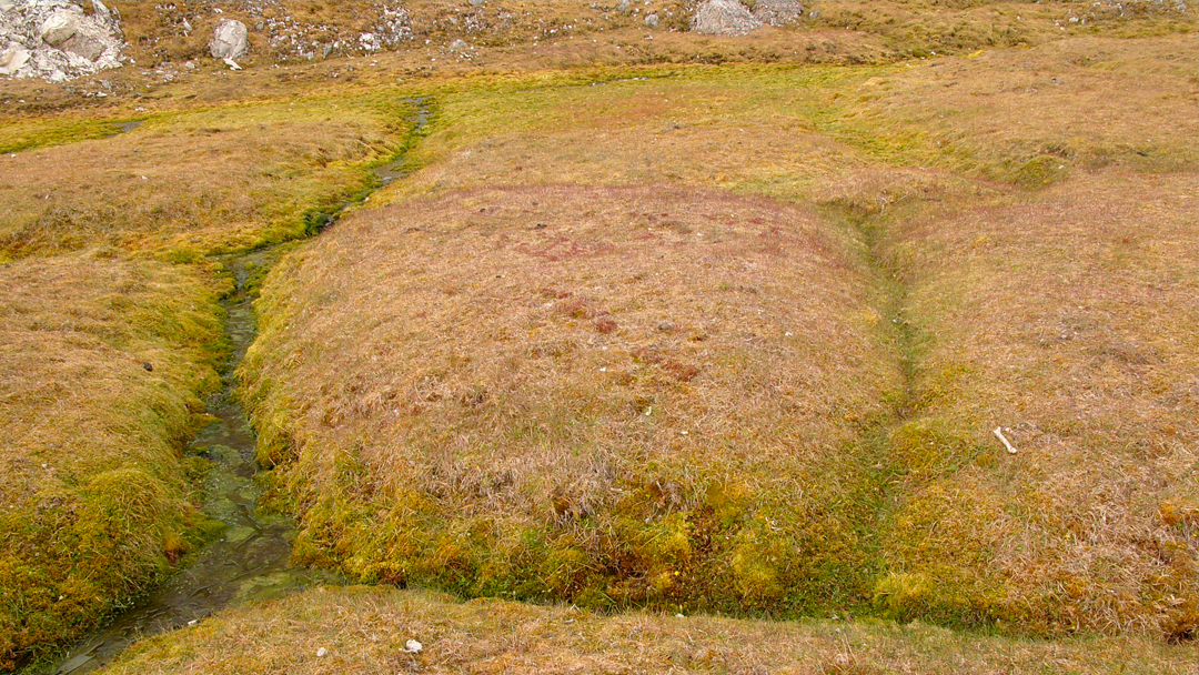
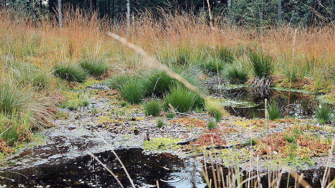
Methane is 25 times as harmful for the climate as CO2 – and its content in the atmosphere is increasing rapidly, for which humans are directly or indirectly responsible: rice fields, cattle industry, mining, rubbish dumps, energy production, or defreezing of permafrost areas. All these are sources of methane. In addition, there are natural sources like swamps, fenlands, termites, forests, and the seas. The knowledge on the total extent of the problem is still fragmentary today – but we learn something new very quickly thanks to satellite observation.
This is where satellites will detect methane
© Hannes Grobe/Wikipedia
© Wikipedia/Jonas Barandun
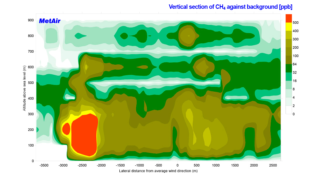
© www.metair.ch; Prof. Dr. Bruno Neininger
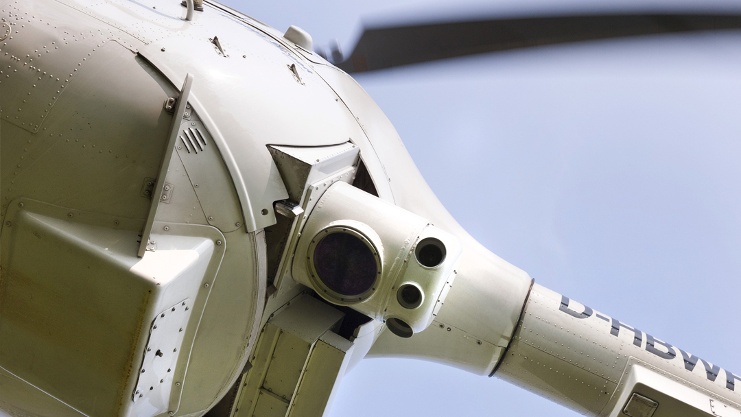
LIDAR: technology from space flight
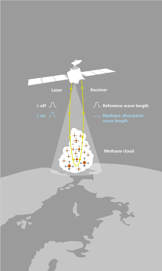
With the aid of the LIDAR technology (LIDAR = Light Detecting and Ranging), the MERLIN satellite will detect methane. Laser light is emitted, reflected or scattered by an object (gas cloud, or soil), and the light returning to the LIDAR instrument is registered. By measuring the time elapsed between transmission and reception of the laser pulse, the distance between the LIDAR instrument and the reflecting object can be determined.
The wave length of the emitted and returned light will reveal the composition and thus the type of the reflecting object – for example methane.
In space flight, LIDAR was first on board in 1971 for the Apollo 15 moon landing mission (the first with a lunar rover). With its help, a map of the lunar surface was drawn up.
LIDAR in everyday life
© Open Grid Europe GmbH, Kallenbergstraße 5, 45141 Essen
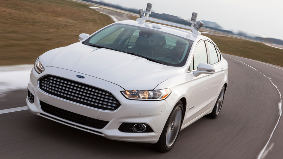
Approach no. 1: LIDAR on every car to scan the environment in real time.
Approach no. 2: LIDAR for mapping. The map service HERE measures streets by LIDAR vehicles with a precision of two centimetres. Thanks to this data, forthcoming autonomous vehicles will need less measuring technology on board.
© Ford Motor Company
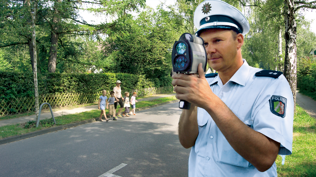
© Jenoptik
© NASA
© Wikipedia/archive.cyark.org
© Archaeology and Development Foundation/Khmer Archaeology LIDAR Consortium

CO2 and CH4:
the main causes of climate change
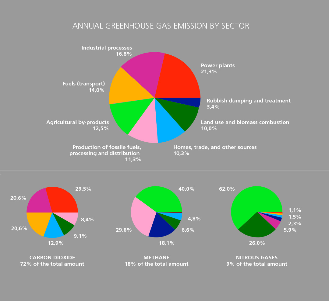
Global warming is speeding up as never experienced before in Earth’s history. For the first time, humans are the main cause: since mid of the 19th century, an ever increasing amount of – man-made – greenhouse gas has ascended into the atmosphere. This is the reason why less heat can escape from Earth to space. The two most important greenhouse gases are CO2 with 72 per cent (carbon dioxide, mainly from coal-fired power stations, industry, and road traffic) and CH4 (methane) with 18 per cent. However, methane is 25 times more harmful to the climate than CO2.
MERLIN: a Franco-German contribution to overcome the climate change
The MERLIN mission has been the first Franco-German project in the field of Earth observation since the year 1994. It has been agreed upon by both nations within the framework of the Franco-German Ministerial Council in February 2010. Taking this step, the two largest space- faring nations in Europe decided to make a perceptible contribution to research on the causes of climate change through their space agencies CNES and DLR.
© CNES/Illustration David DUCROS, 2016
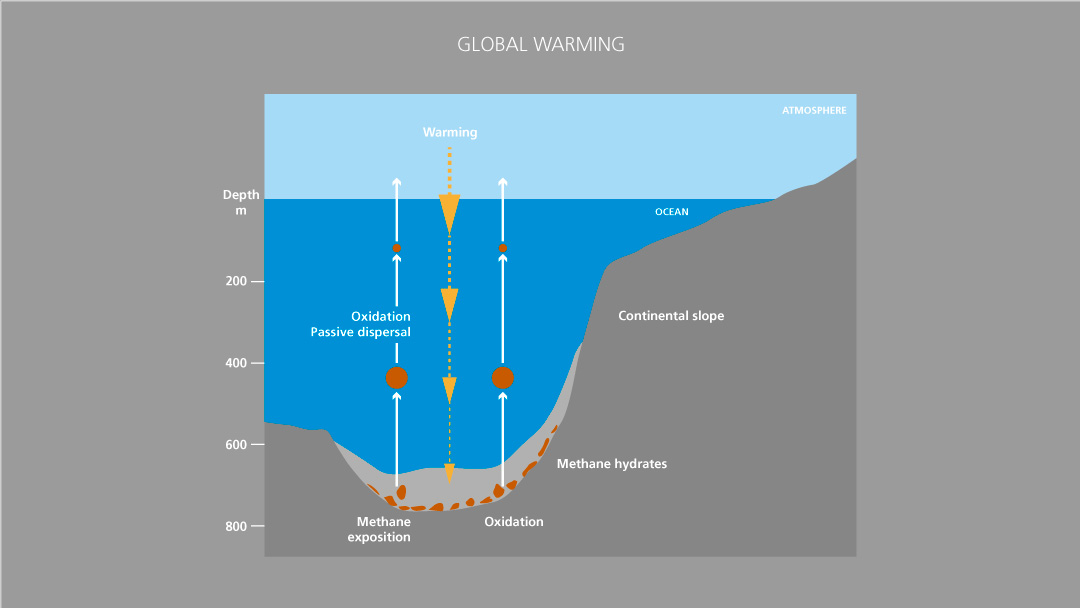
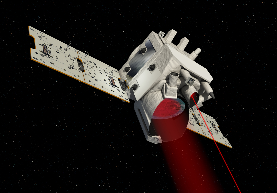
Permafrost soils are defreezing; fenlands are emitting gas – with MERLIN watching. The Franco-German mini-satellite MERLIN (Methane Remote Sensing LIDAR Mission) is supposed to monitor methane in the Earth’s atmosphere over a period of three years starting in 2024. With the aid of a LIDAR instrument (Light Detecting and Ranging), it will trace and monitor greenhouse gas in the Earth’s atmosphere from an altitude of about 500 kilometres. The aim is to draw up a world map of methane concentrations – to precisely identify the sources and the places in which methane is withdrawn from the atmosphere. First methane data from the troposphere are already delivered by the Copernicus satellite Sentinel-5P, although not with active LIDAR technology but with passive sensors.
LIDAR on board
MERLIN will be equipped with a further developed LIDAR system. It is capable of measuring the quantity and distribution of methane in the Earth’s atmosphere, during the day, at night, or straight through thin cirrus clouds. For measuring the concentration of gases, light pulses are emitted on two wave lengths (“colours”) close to each other. One of these wave lengths is absorbed by the trace gas searched for, the other is not. From the difference of the two signals scattered back from the ground to the satellites, the methane concentration can be determined very precisely.
The satellite will once orbit the entire Earth within a month and search for natural and man-made sources of methane. 50 times per second, the laser beam is transmitted to Earth and received. The measuring values recorded by MERLIN can be re-calculated by scientists with the help of data on wind speeds and directions to draw up global methane “movement maps“.
Technological development from Germany
The technologies for the LIDAR instrument to be installed on MERLIN come from German industrial enterprises and research institutions. Within different projects funded by German Space Agency at DLR and ESA, technologies for future LIDAR instruments have been developed and tested by, among others: Airbus Defence and Space (Ottobrunn), SpaceTec GmbH (Immenstaad), Hoerner & Sulger (Schwetzingen) as well as by the Fraunhofer Institute for Laser Technology (Aachen) and the DLR Institute of Atmospheric Physics (Oberpfaffenhofen). The programmes for processing MERLIN data as well as the control of the MERLIN instrument are developed by the DLR Remote Sensing Technology Institute (Oberpfaffenhofen) and SciSYS GmbH (Bochum).
On the German side, the scientific responsibility for the instrument is assumed by the LIDAR department of the DLR Institute of Atmospheric Physics (IPA) in Oberpfaffenhofen. It already develops and operates aircraft-based LIDAR systems for measuring e.g., wind speed, water steam, methane, or the carbon dioxide content of the atmosphere. The methane and carbon dioxide LIDAR CHARM-F developed by the IPA is based on the same measurement principle as MERLIN. It is deployed on the DLR research aircraft HALO thus ensuring that this measuring method for the MERLIN mission can be tested beforehand.
Strong cooperation with France
The French space agency CNES will be in charge of the entire system and the satellite bus as well as the operation of the satellite and the launcher. As a platform for this purpose, CNES is developing the so-called MYRIADE Evolution Platform. So, the MERLIN platform will become the prototype for a new series of future high-performance minisatellites. A scientific concept study and a technical feasibility study have been successfully conducted jointly by CNES and German Space Agency at DLR in the years from 2010 to 2012. In the next step, a technical design for the satellite system will be drawn up. The launch of MERLIN is scheduled for 2024. Both nations jointly see to the payload ground segment and the scientific evaluation of the methane data.
| Launch | 2024 |
| Orbit altitude | approx. 500 km |
| Type of orbit | low polar sun-synchronous orbit |
| Satellite mass | 430 kg |
| Satellite size | approx. 160 x 450 x 160 cm with unfolded solar panels |
| Satellite bus | MYRIADE Evolution (from France) |
| Instrument | Methane LIDAR (from Germany) |
| Measurement principle | Integrated Path Differential Absorption (IPDA) |
| Instrument mass | approx. 150 kg |
| Energy consumption LIDAR | approx. 150 W |
| Laser wave lengths | 1645.552 nm (on)/1645.846 nm (off) |
| Pulse energy laser | 9 mJ |
| Pulse rate laser | approx. 20 Hz (double pulse) |
| Data rate | approx. 300 kbps |
| Data volume per orbit | approx. 1,6 Gbit |
| Mission duration | 3 years |
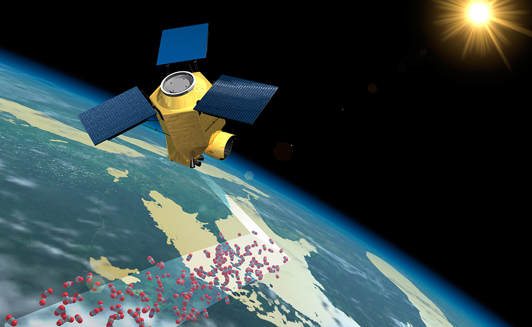
The CO2M satellites: humans or nature – who causes carbon dioxide and methane, and where?
© Airbus DS GmbH 2015
How are carbon dioxide and methane globally distributed? Where are they emitted and to what extent? Where are the hot spots? Where do plants act particularly strongly as “hollows” through photosynthesis? This is what the ESA satellites of the CO2M mission are supposed to investigate starting 2025. The resolution of the satellite images will be sufficiently high to analyse even gas plumes of individual power plants or industrial plants. In this way, we will get a clear picture showing which greenhouse gases are anthropogenic and to what extent – these are unsurpassed data worldwide that never existed before.
Key preparatory work for this mission comes from research by Bremen University. The new satellites will be based on the CarbonSat concept of the Institute for Environmental Physics (IUP). The scientists will continue to be committed to the development of the CO2M system. The CarbonSat concept has been supported by DLR.
The funding for the construction of the CO2M satellites is provided by the Copernicus programme.
© Airbus DS GmbH 2015