Disaster prevention
from space
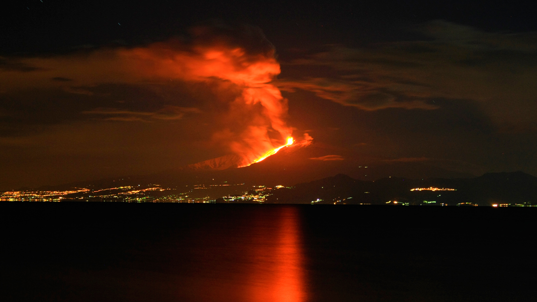
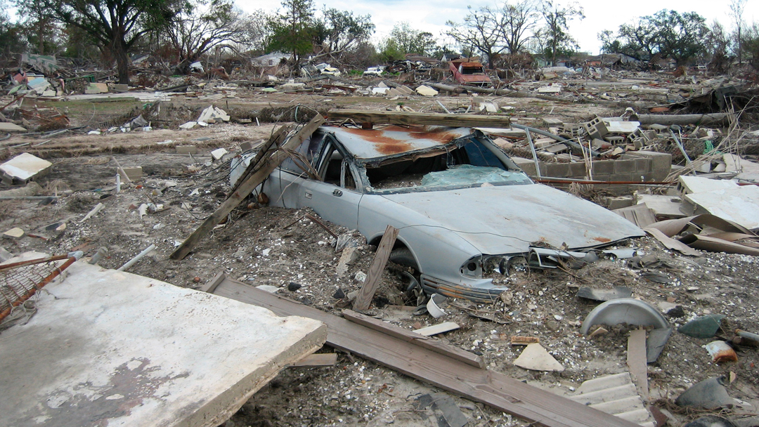
When a volcano erupts, aeroplanes have to stay grounded. Typhoons, flooding, and earthquakes devastate huge land domains. Forest fires and landslides destroy residential estates. We cannot prevent natural disasters from happening; however, we are able to predict them with increasing precision – with the help of satellite data.
Weather satellites such as the European Meteosats, radar satellites such as the German TerraSAR-X and TanDEM-X or the European Sentinel-1 and optical satellites such as Sentinel-2 are scanning the Earth around the clock. Meteorologists and disaster prevention personnel evaluate the data. Changes of the Earth’s surface might signalise forthcoming disasters. Before and after comparisons elucidate the extent of destruction in next to no time. This in turn is the basis for disaster relief being as efficient as possible.
Situation maps of disaster areas are drawn up, for example, by the DLR Center for Satellite Based Crisis Information, by the Federal Agency for Cartography and Geodesy, or by the European Copernicus Emergency Management Service. They are used all over the world.

© Wikipedia/Cirimbillo
© ESA/DLR
© Wikipedia
© Wikipedia
© DLR
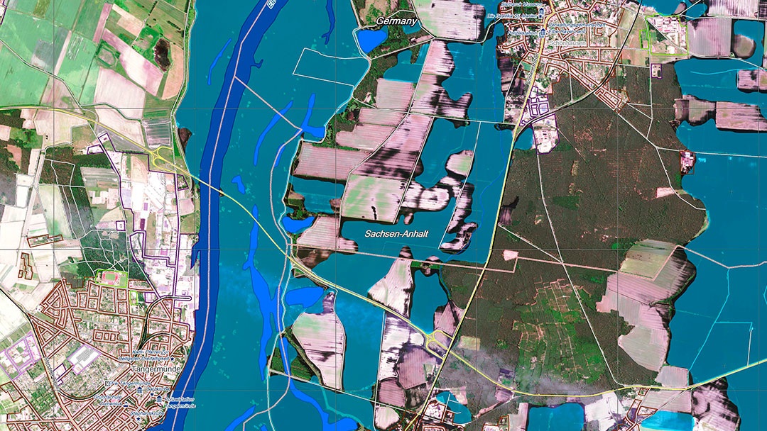
© DLR/ZKI
© GIO EMS – Mapping
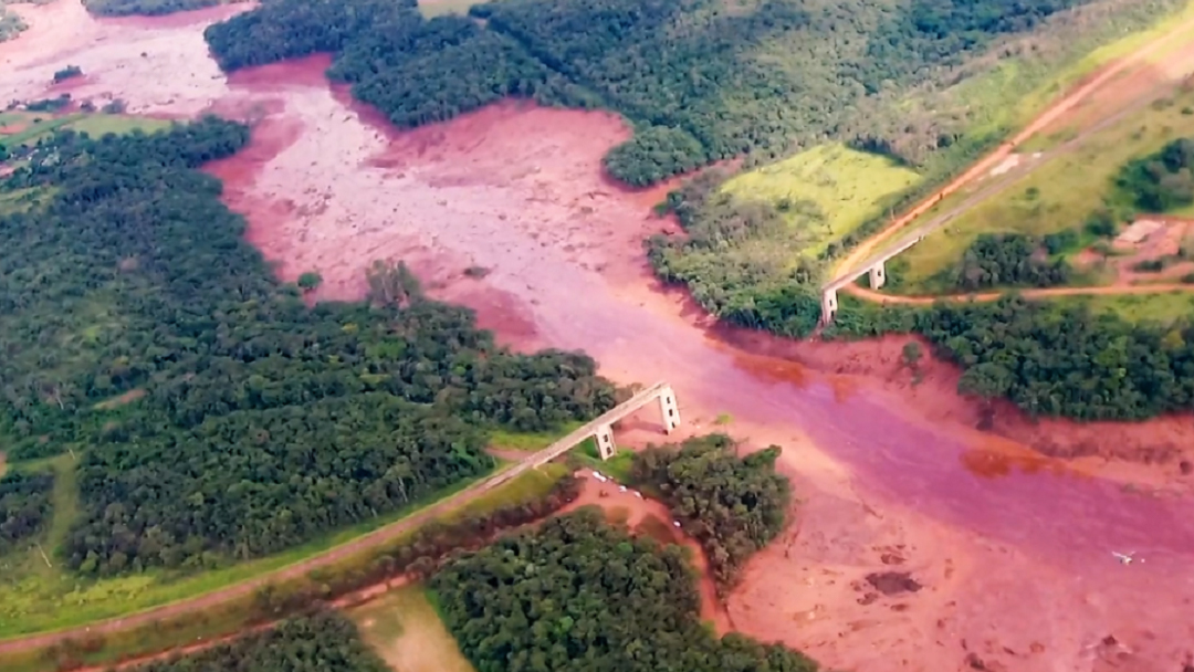
© TV NBR/Wikimedia Commons
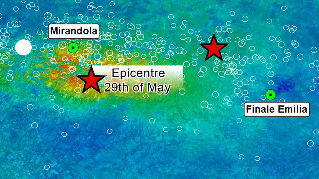
© Istituto Nazionale di Geofisica e Vulcanologia (INGV). Satellite Data: Cosmo-SkyMed
© getty images
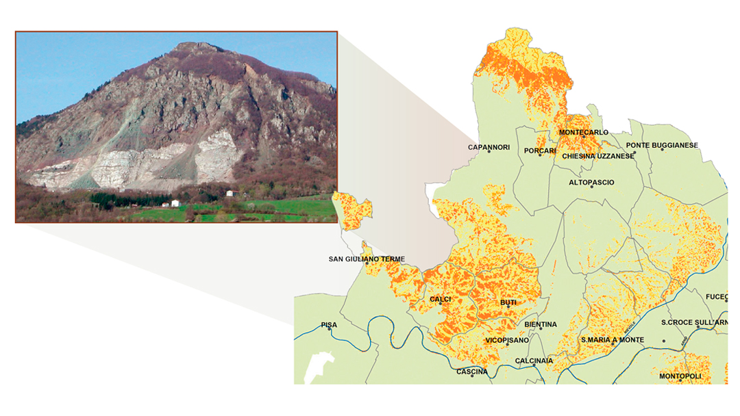
© UNIFI
© ESA
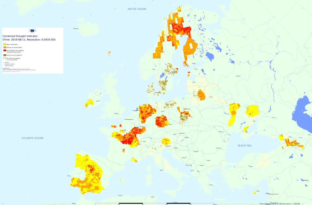
© European Drought Observatory (European Commission - Joint Research Centre), Copernicus Emergency Management Service, 2020
Disaster warning for the trouser pocket
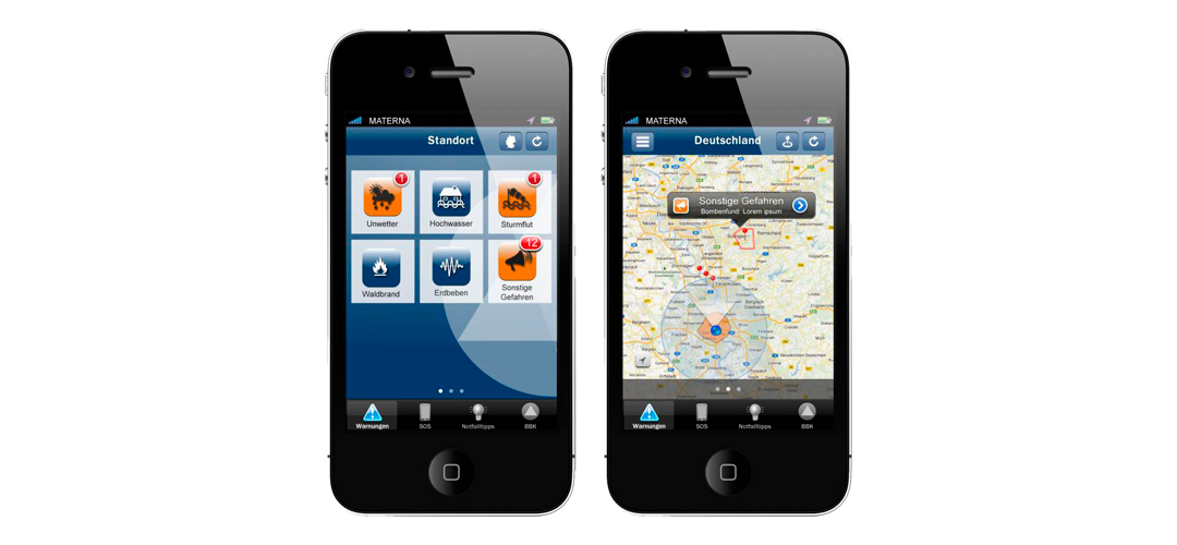
The warning app NINA of the Federal Office of Civil Protection and Disaster Assistance sets off an alarm if the own environment is threatened by a disaster or severe weather – as a warning system running in parallel to sirens and radio. NINA is connected to MoWaS, the modular warning system. The warning message is transmitted by the releasing control centre, well protected against power failure and disaster, via satellite (and, in addition, via cable) and thus reaches the warning systems, like, for example, NINA.
© BBK

The European Copernicus Emergency Management Service (EMS)
Flood disasters, storms, forest and bush fires, earthquakes, volcano eruptions, landslides, tsunamis, or disasters caused by human activities (chemical accidents, reactor accidents, oil spill, wars, and refugee affliction) are threatening humans and nature in many places. Those who live in an endangered region often lose all their belongings in a disaster.
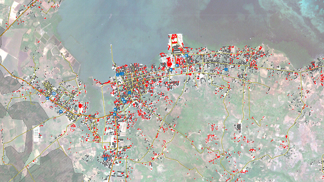
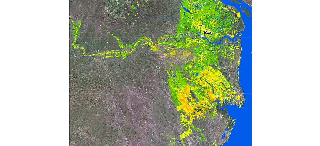
In cases of disaster, the EMS has been providing bundled disaster information since April 2012. This is the basis for supporting staff to prevent consequences that would be even worse. Depending on place and situation, updated damage maps are submitted to supporting staff within few hours after the inquiry or can be accessed online.
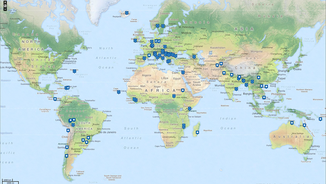
These are the emergencies in which EMS services were used. EMS builds on a series of projects initiated by the European Commission and ESA, and in particular on the data of European satellites. The Sentinel satellites are particularly important. Sentinel-1, for example, supports the detection and assessment of floods, landslides and seismic movements. Sentinel-2 provides basic maps and data on inundations, erosion, and makes various land utilisation visible. Sentinel-3 can detect fire, and Sentinel-5P detects air pollution.
© EMS/CCBYSA/OpenStreetMap contributors
© ESA
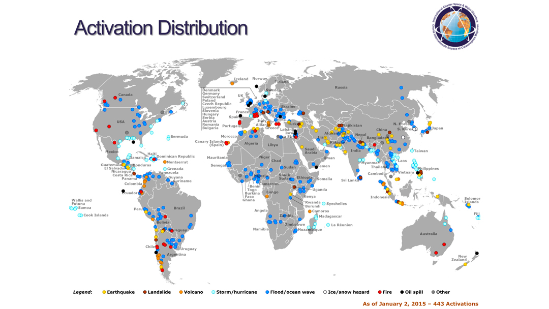
The commitment of the DLR in disaster management: membership in the “International Charter Space and Major Disasters”
© DLR/Esri/GEBGO, NOAA, National Geographic, DeLOrme, HERE, Geonames.org and other contributors
Over 600 activations in the 20 years since its foundation: the DLR in its capacity as German space agency contributes its satellites and expertise in disaster management on a global basis through its membership in the “International Charter Space and Major Disasters”. The charter designates the consolidation of numerous space agencies making available satellite images and information derived from them as quickly as possible and free of charge if a major natural disaster has occurred somewhere on Earth.
Disaster management authorities throughout the world can register as users of the charter and can activate the help mechanism in case of a disaster on their own.
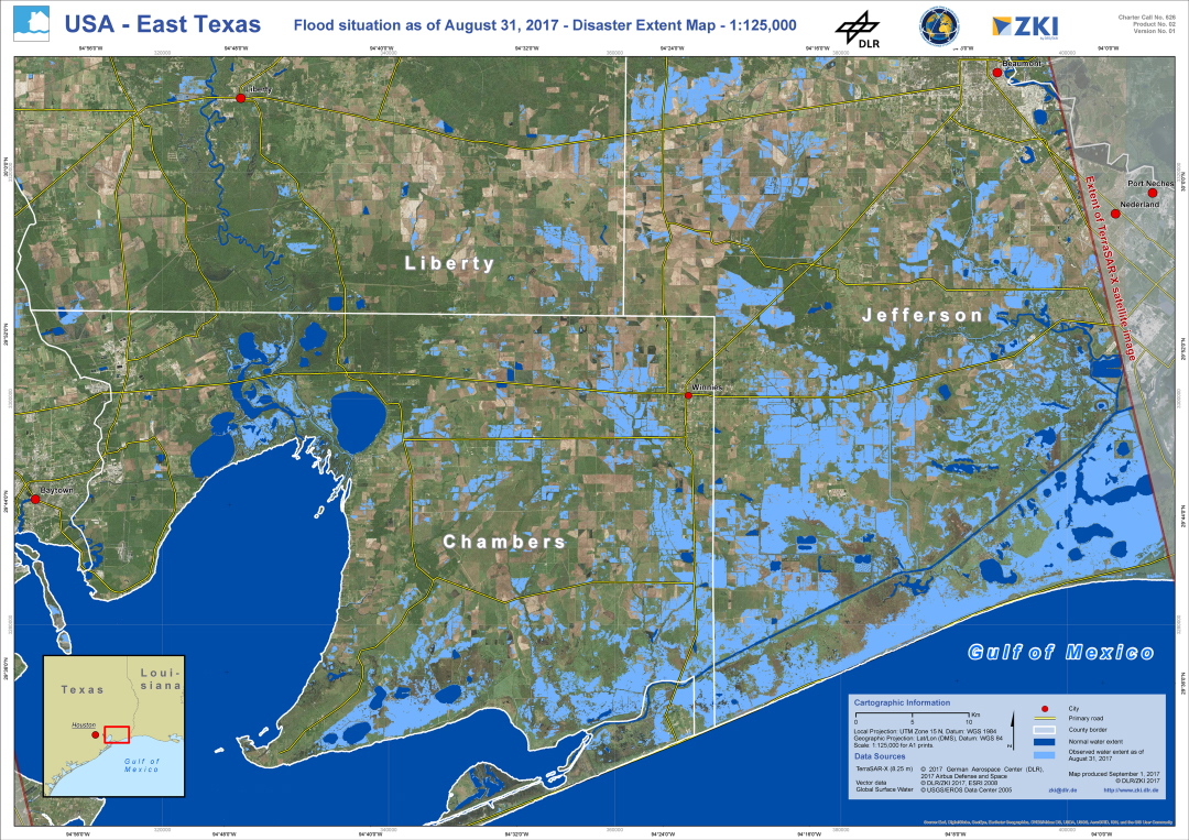
Within the framework of its charter membership, the DLR provides data of the German radar satellites TerraSAR-X and TanDEM-X as well as optical RapidEye images for disaster management.
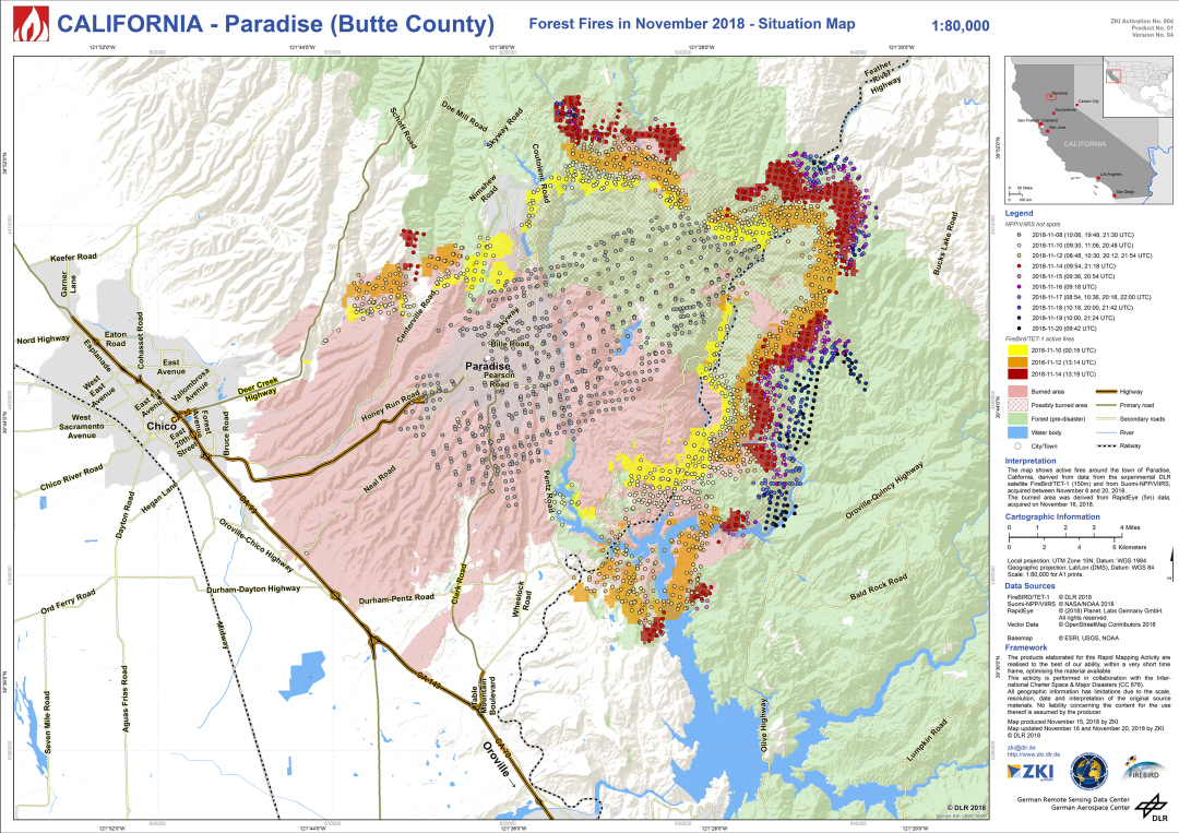
FireBIRD: the German fire detectors in space
© ZKI/DLR
The German satellites TET-1 and BIROS are members of the “FireBIRD” team. The two “firebirds” are flying at an altitude of 520 kilometres and detect forest fires and smaller fires through infrared sensor technology. The aim is not only the detection of fires but most notably the documentation of their spread. In this way, fires can be better researched – and that can contribute to preventing some fires in the future. The data from FireBIRD are also used by the ZKI.
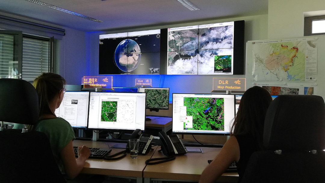
The DLR Center for Satellite Based Crisis Information (ZKI)
© ZKI/DLR
In addition, the DLR operates its own Center for Satellite Based Crisis Information (ZKI), among other things to be able to quickly respond to requests of German authorities.
- Procurement and analysis of satellite image data in critical situations and for the security of major events
- Basic and emergency mapping according to user needs and situational needs
- 24/7 standby operation
- Training and education of crisis response staff
- Support of civil defence exercises
© DLR
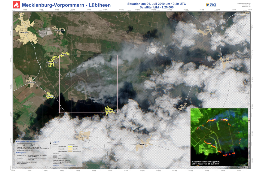
Major fire on a military training area, Mecklenburg-West Pomerania. On June 28, the fire was reported as “extinguished”. However, hot spots sparked new fires. The map is of July 1, 2019: relief forces can see on the map provided by the ZKI, which villages are threatened by the fire, which streets are passable, and first of all, the fire sources and hot spots – since satellites can “see” through clouds and treetops. In this way, relief forces can do better planning. The data come from the Sentinel-2 satellite and show, on the one hand, the area in “true colours” and, on the other hand, as false colour imaging, created with the help of near-infrared channels.
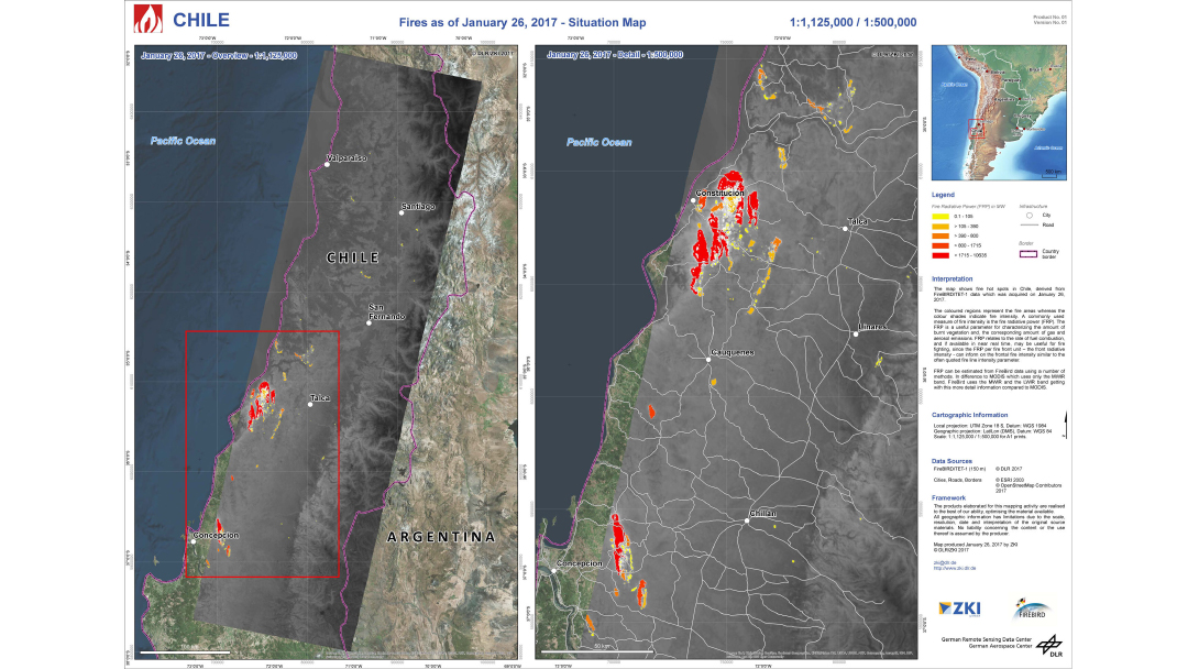
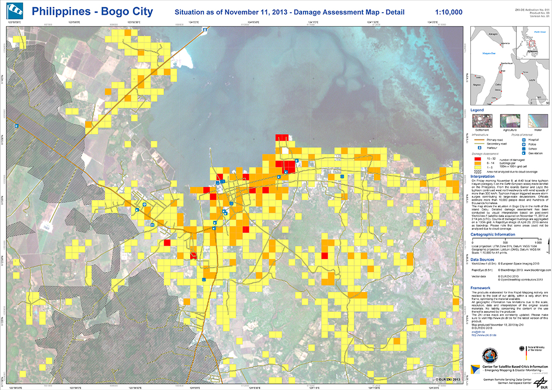
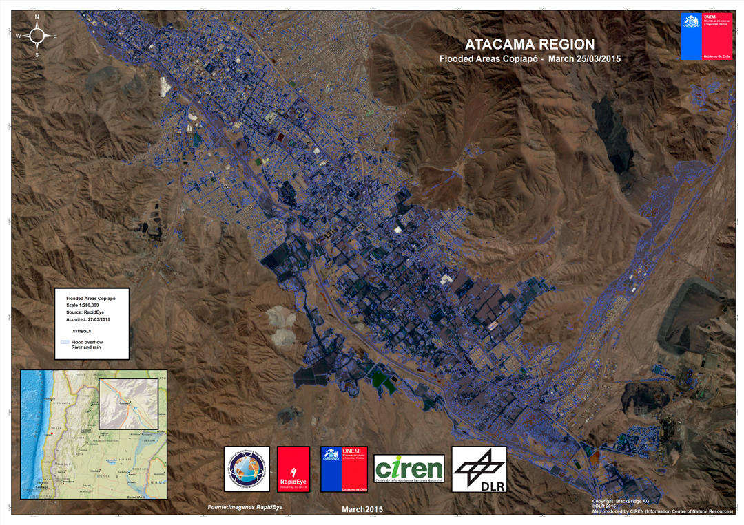
Examples of charter activations
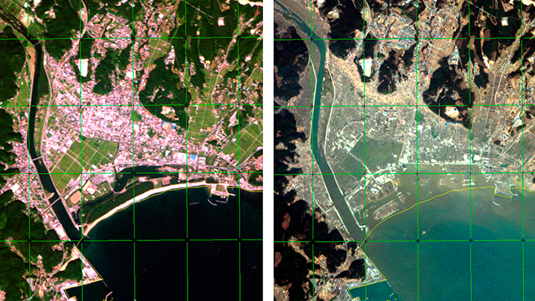
© JAXA
© DLR
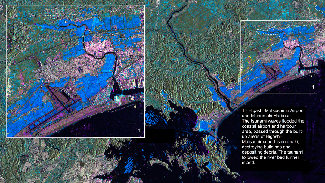
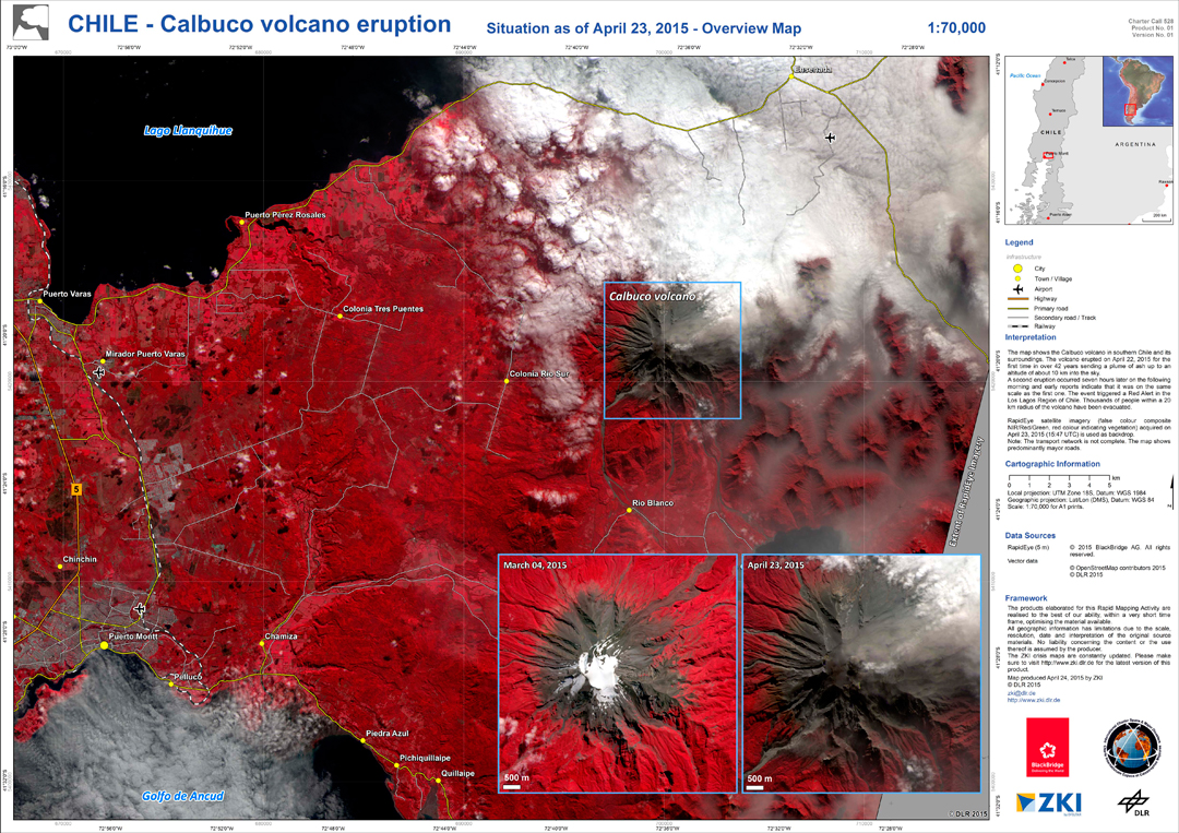
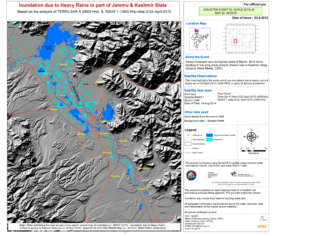
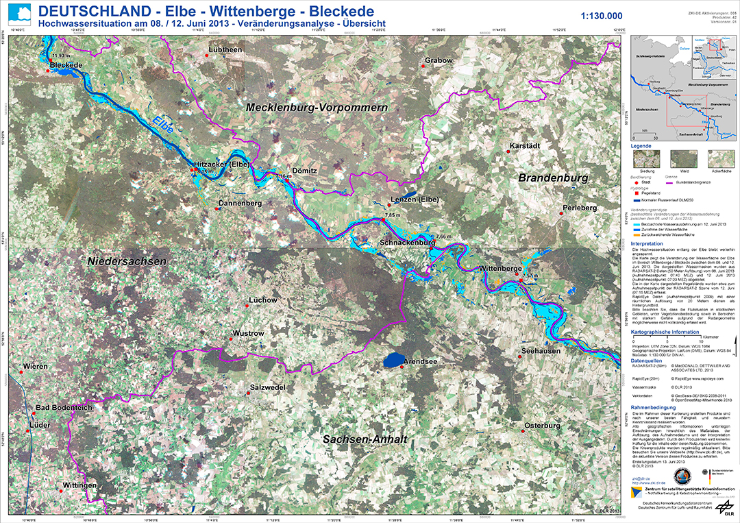
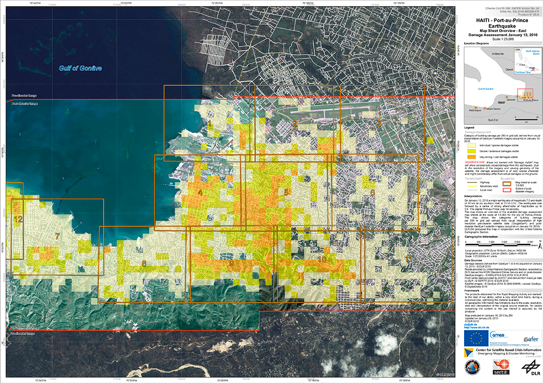
This is how maps look like that have been drawn up within the framework of the charter
© ZKI/DLR
© ZKI/DLR
© DLR
© DLR
© DLR
© DLR
© DLR
© DLR