And now:
the diving forecast from space
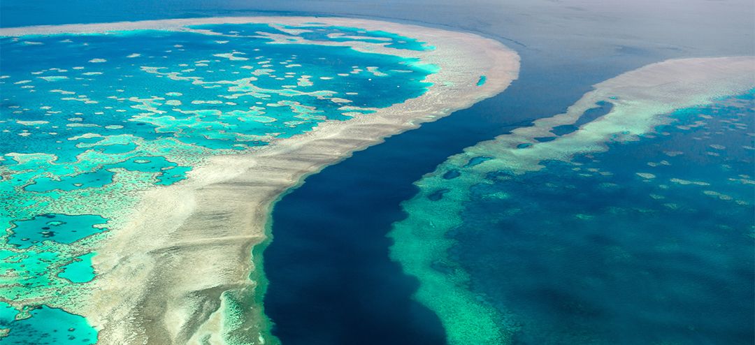
Clear visibility at the Great Barrier Reef?
In clear waters, diving is real fun. However, since the preparation of a dive at sea is a challenging task in terms of logistics, it would be fine to have reliable information on the water quality beforehand – for not having to dive in muddy waters.
© EOMAP GmbH & Co. KG
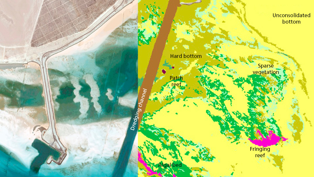
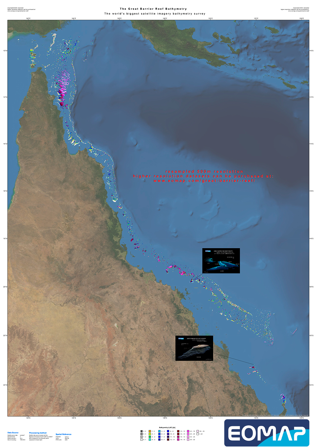
For one of the greatest diver’s paradises in the world, the Great Barrier Reef in Australia, as well as for many other waterbodies across the globe, now a website is available for optimum planning of the dive. Its contents: the first high-resolution map of the reef to a depth of 30 metres and visibility conditions updated on a daily basis.
The free of charge web application “eoApp” (http://eoapp-au.eomap.de or worldwide at http://eoapp.eomap.com) shows how troubled the water currently is (i.e., how many particles such as sediments, are in the water) and how far one can see under water. Moreover, the structure of the reef and the seabed as well as the depth can be recognised.
Incidentally, changes at the reef can also be monitored over a long period of time. After all, it is not only a tourist attraction but a very fragile ecological system, which unfortunately is very much at risk due to environmental influences. Currently, in the immediate vicinity a port for coal ships is being built, with the spoil simply being disposed of in the sea. The authorities have recognised this threat and are planning to monitor the water quality explicitly by using satellite data. The development can be watched through eoApp.
What is interesting as well: this is not an Australian service. It is the work of EOMAP, a spin-off of DLR headquartered near the Bavarian Ammersee.

© EOMAP GmbH & Co. KG
© EOMAP GmbH & Co. KG
© EOMAP GmbH & Co. KG
© superjoseph - stock.adobe.com
© EOMAP GmbH & Co. KG
© EOMAP GmbH & Co. KG
Mapping of the ice coverage of the ocean, derived from satellite data, is possible as well. For this purpose, an additional “satnav” for ships named “Ice Pad” is available from the MARSAT partner Drift+Noise Polar Services GmbH.

Water protection made in Bavaria
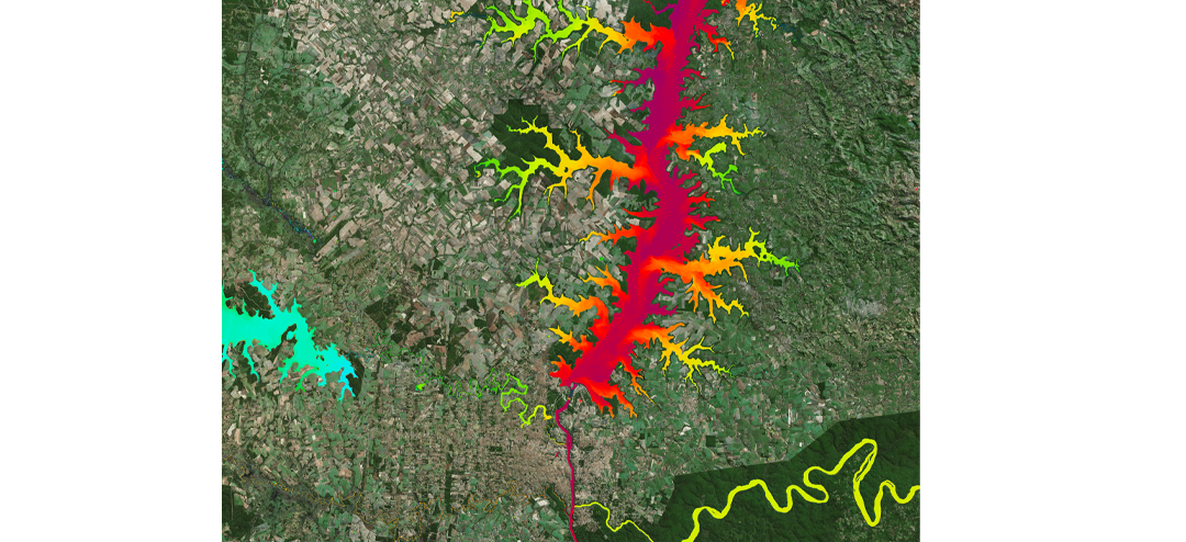
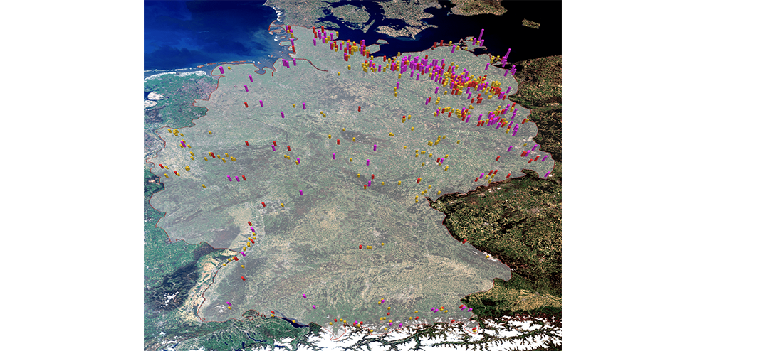
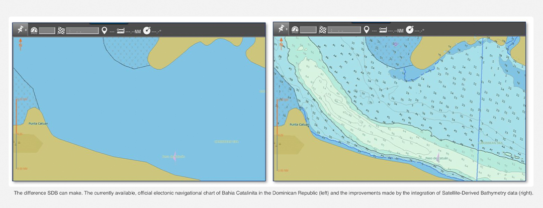
Daily updated water quality data from lakes and coastal waters all over the world. This has only come true since 2014, from the German world market leader in a market previously not existing at all – and that could only emerge thanks to Earth observation satellites. This data is not only interesting for divers, but also for environmental authorities and industry (e.g. operators of aquacultures, oil and gas production, keeping fairways clear and building artificial islands).
© EOMAP GmbH & Co. KG
EOMAP is a DLR spin-off headquartered in the Bavarian city of Seefeld. As a mapping service provider, it takes a leading role in environmental monitoring. Coastal and inland waters all over the world are monitored and the water quality or pollutions by oil made visible.
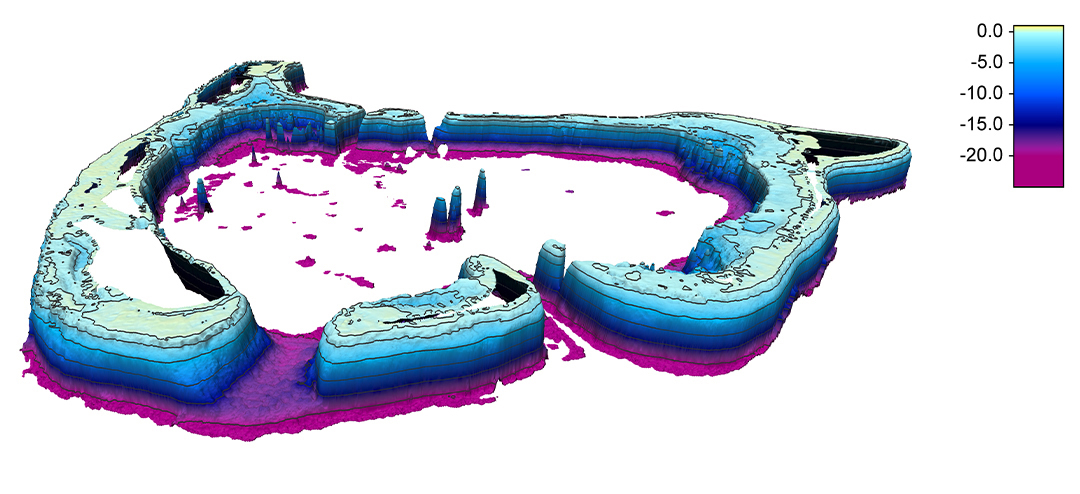
EOMAP is the leading provider of bathymetric maps, i.e. maps of the seabed, and of maps depicting the benthos, i.e. the living organisms existing in the soil zones of waters.
Scientists, companies and authorities can buy the global water quality data in a web shop. For the first time, such data, which are updated daily, can be used quickly and easily.
They come from different satellite systems, for example, from the European Sentinel family, Worldview, Landsat, and MODIS.
© EOMAP GmbH & Co. KG