Planning holidays
with the “view from above”
When planning their holidays, many people rely on recommendations, books, or assessments on the Internet. However, all this information has been generated some time in the past. Is it still relevant? High-tech satellites from space will increasingly provide “real-time” information from all over the world.

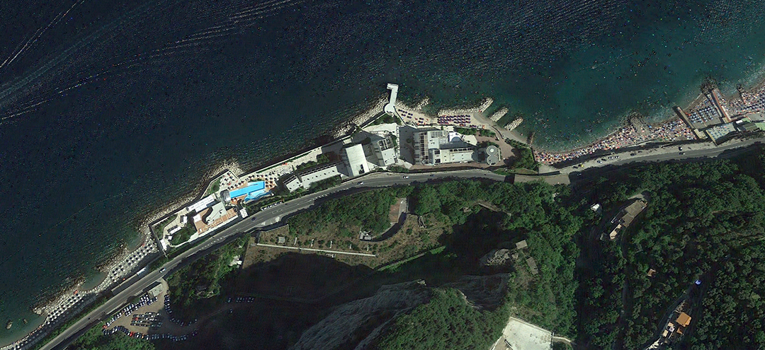
Beach holidays
(data rate: 300 Mbit/s). In Germany, the DLR ground stations in Oberpfaffenhofen and Neustrelitz are receiving the images.
© Google Earth
© EOMAP GmbH & Co. KG
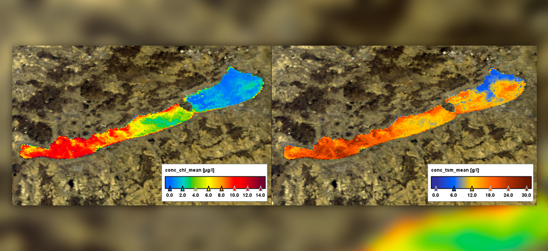
© Original data: MERIS FR © ESA; Image processing: Brockmann Consult GmbH
© Original data: MERIS FR © ESA; Image processing: Brockmann Consult GmbH
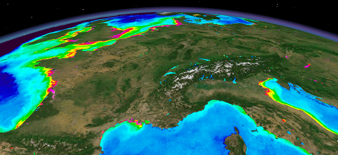
Holiday in town
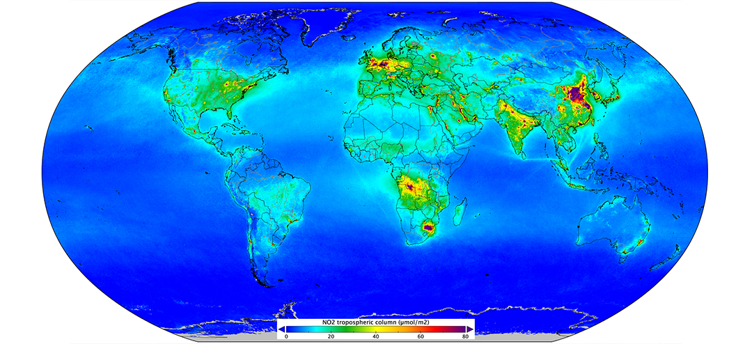
© ESA, contains modified Copernicus data (2018), processed by KNMI
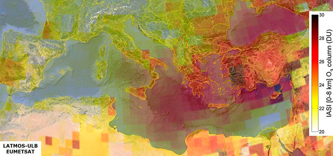
ozone on the ground irritates the respiratory tract and may cause a headache. Measuring from
space instead of measuring at individual spots on the ground or by balloon continuously delivers
consistent data worldwide. Up to now, the weather satellite MetOp with various sensors is in charge
of ozone measurement. In future, this task will be assumed first and foremost by Copernicus with
Sentinel-4 and -5.
© EUMETSAT
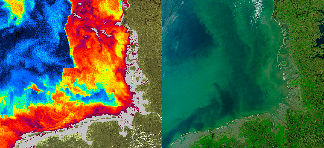
Holidays in nature
© GEOSYSTEMS Polska Sp. z o.o.
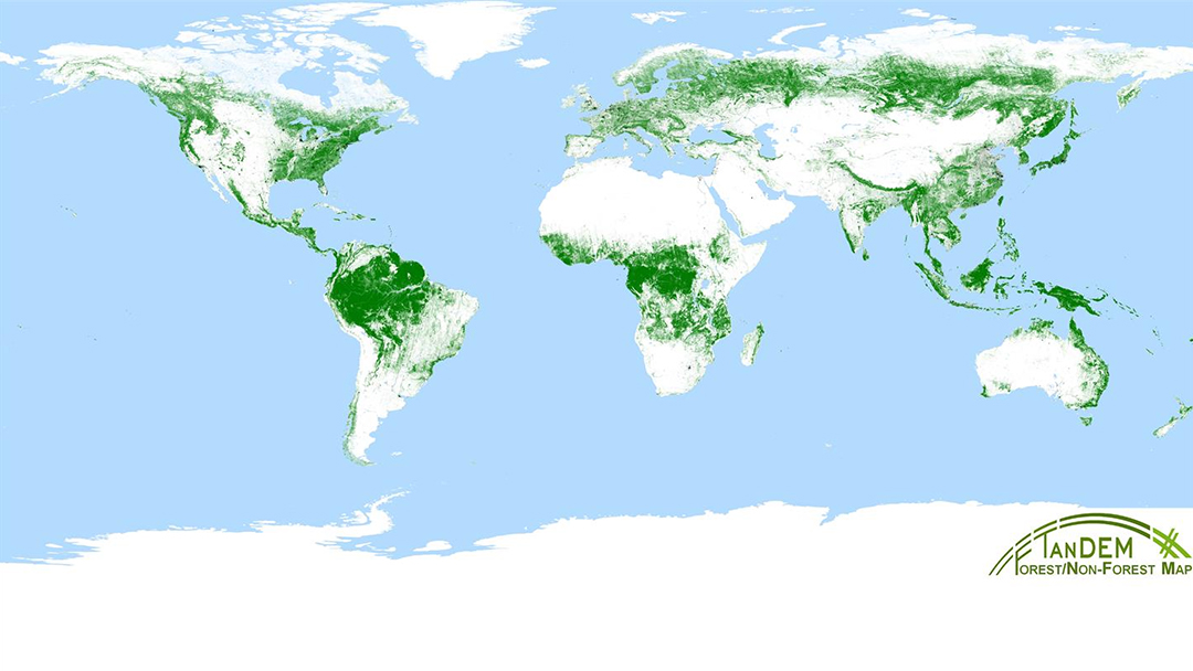
© DLR CC-BY 3.0
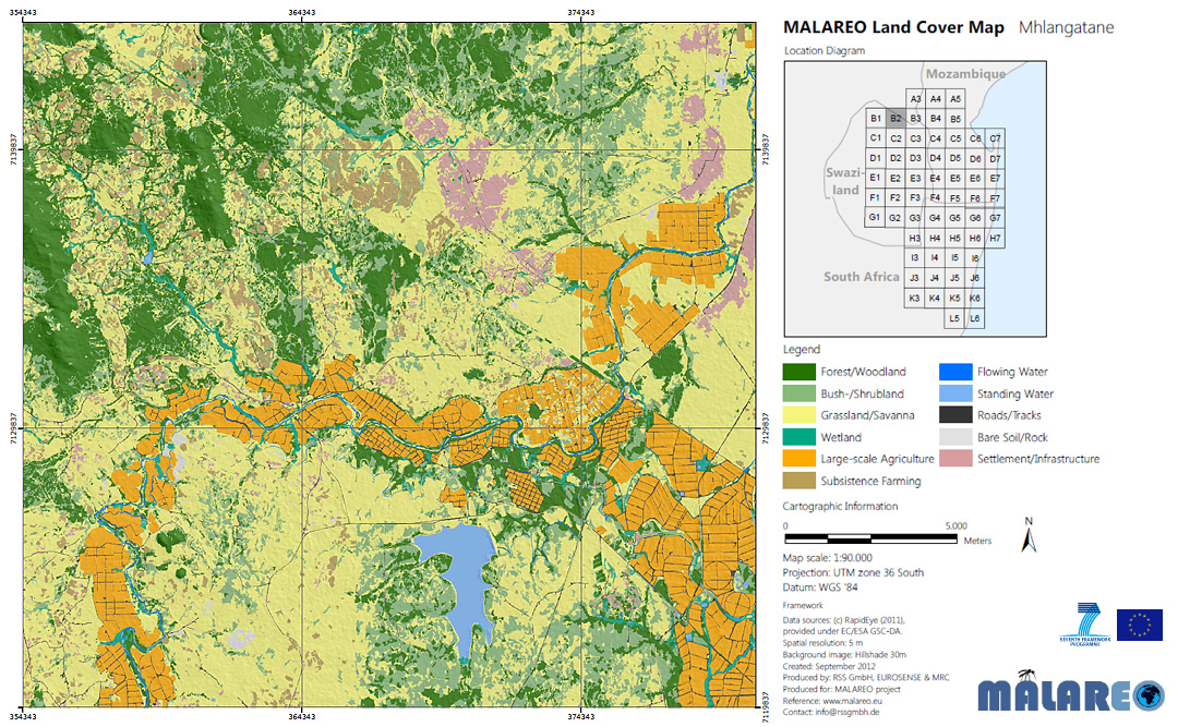
© www.rssgmbh.de
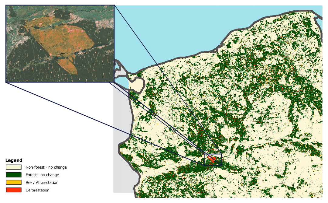
Holidays on your doorstep
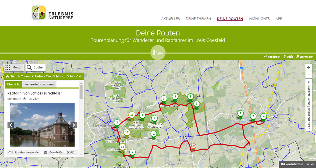
© Naturschutzzentrum Kreis Coesfeld e. V.
Flight cancelled?
When volcanos bring air traffic to a halt
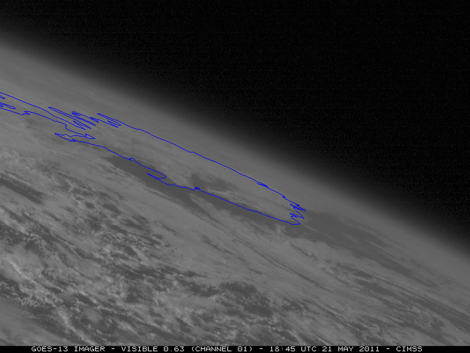
© ESA
Eyjafjallajökull. Grímsvötn. Bárðarbunga. On Iceland, a volcano erupts; the ash cloud brings air traffic to a halt. Trip home adjourned indefinitely. When the Eyjafjallajökull erupted, on April 15, 2010 alone about 7,000 flights were cancelled since the ashes are a great threat to aircraft engines. The MetOp satellites have instruments on board that can detect sulphur dioxide – and thus volcano clouds. The DLR Earth Observation Center collects these data in real time and can derive corresponding information that can contribute to flight warnings or all-clear signals.
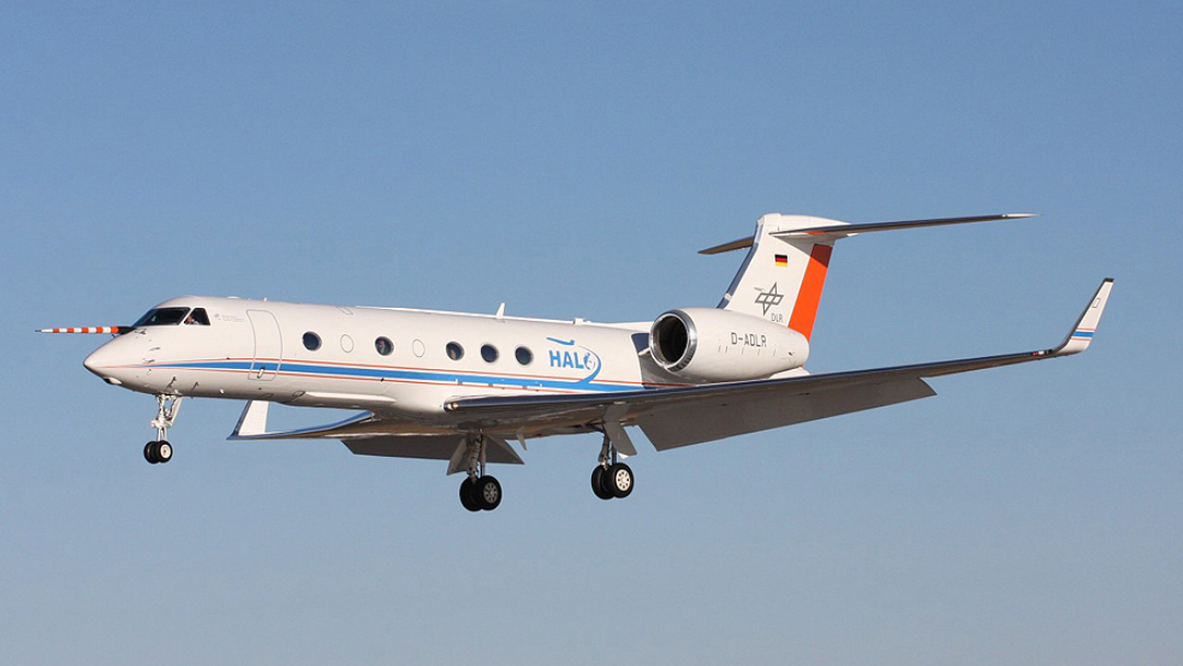
But how do scientists know whether the satellite data is really correct?
By checking them time and again on the spot. The ash concentration of volcanos (and more) is measured by a special DLR aeroplane from the site in Oberpfaffenhofen. The HALO Gulfstream G 550 (the successor of a Dassault Falcon 20E) is a flying laboratory picking its samples directly from the air – and all that at an altitude of up to 15,000 metres.
© DLR

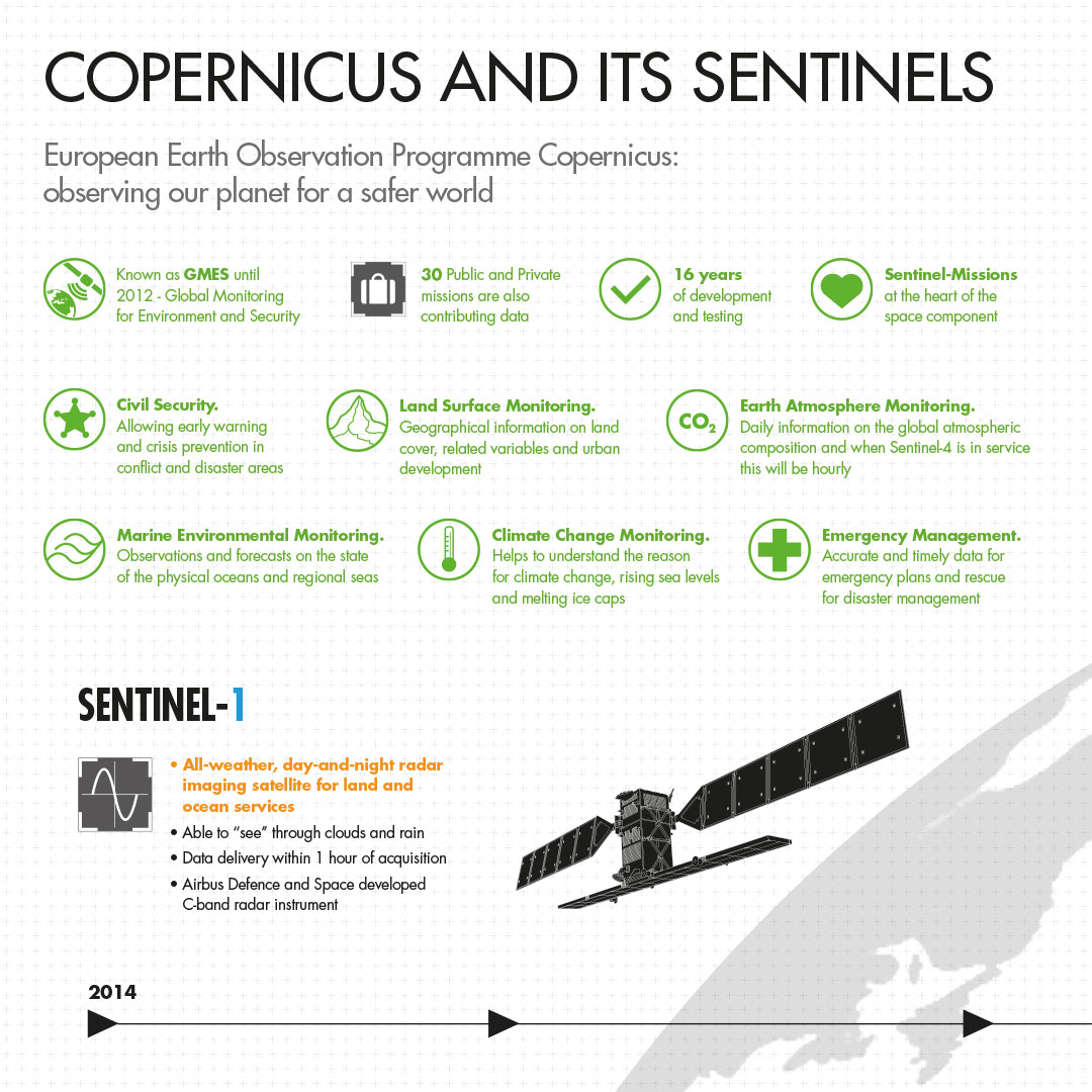
Copernicus: the European Earth observation programme
Satellites are documenting continuously and over a long period of time how the Earth changes: how does the climate change influence our environment? What is the impact of natural disasters – and could they possibly be predicted in order to save humans or enable faster help? How do cities change? How can agriculture and forestry be supported? How can data on air quality assist in preventing allergies, skin cancer, or asthma?
Earth observation is teamwork. This is why the EU initiated the European Earth observation programme Copernicus. The Copernicus programme is unique worldwide and very ambitious. What is more, the data obtained by Copernicus are accessible to everybody free of charge. Each citizen may download, explore, and further use this unique satellite data with a few mouse clicks only – and even currently updated. Every three years, data on forest coverage and other land coverage issues all over Europe will be updated with the help of Copernicus.
- Land surface monitoring
- Monitoring of the maritime environment (seaways, protection of the sea)
- Monitoring of the atmosphere (air quality)
- Supporting disaster and crisis management (evaluation of information from natural disasters like earthquakes, volcano eruptions, and flooding)
- Monitoring of the climate change
- Civil security
The primary goal is to create a sound information basis for European and national environmental and security questions. But also the citizens, science, and industry are to benefit from these services.
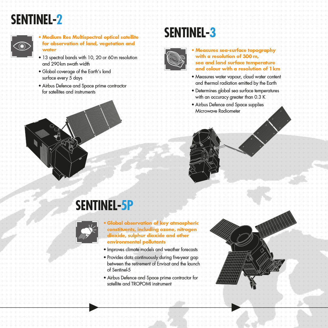
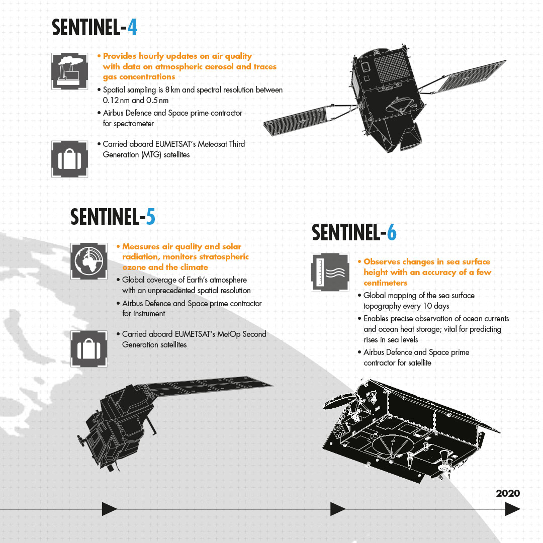
In 1998, the starting pistol for Copernicus was fired. Since 2014, Copernicus has been a fully operational programme, both speaking in terms of information services and satellites. Important milestones were the launch of the first Sentinel-1A satellite on April 3, 2014 and that of the second satellite, Sentinel-2A, on June 23, 2015. Sentinel-5P was launched on October 13, 2017. In total, Copernicus comprises six Sentinel missions that are to be launched successively during the next years.
© Airbus DS GmbH 2015
© ESA
Already in space: the MetOp satellites
The three identically constructed MetOp satellites are weather satellites that perfectly complement the “normal” MeteoSat weather satellites. Whilst the MeteoSat satellites are “geostationary”, that means they always monitor the same part of the Earth’s surface from a fix point at an altitude of 36,000 kilometres, the MetOp satellites are “polar-orbiting”: they are orbiting the Earth and are capable of scanning it completely within 100 minutes and from an altitude of 817 kilometres only, which enables the depiction of more details.
The first satellite, MetOp-A, was launched in 2006, its successor, MetOp-B, has been in orbit since 2012, and MetOp-C since 2018. The satellites B and C were initially intended to be successors, however, since all three satellites are working well, now all satellites deliver high-quality data – in the same orbit, but offset by 120 degrees. On board the MetOp satellites, there are 13 measuring instruments capable of measuring the temperature and humidity profiles of the atmosphere as well as wind speeds or trace gases, but they also include receivers for emergency calls. For these satellites, too, successors are under development. The first satellite of the EUMETSAT Polar System – Second Generation (EPS-SG) is to be launched by the end of 2022.
The main objective of European satellites: making weather forecasts more precise and improving research of weather and climate correlations.
- IASI – Infrared Atmospheric Sounding Interferometer – measurement of air and sea surface temperature as well as measurement of air humidity and content of trace gases
- MHS – Microwave Humidity Sounder – measurement of air humidity in the atmosphere
- GRAS – Global Navigation Satellite System Receiver for Atmospheric Sounding – measurement of the temperature and air humidity in the upper troposphere and the stratosphere with high vertical resolution
- ASCAT – Advanced Scatterometer – measurement of wind speed and wind direction above the sea surface and of soil humidity over land
- GOME-2 – Global Ozone Monitoring Experiment-2 – drawing up of ozone profiles of the atmosphere
- AMSU-A1/AMSU-A2 – Advanced Microwave Sounding Units – measurement of maritime ice, temperature and air humidity under all weather conditions
- HIRS/4 – High-resolution Infrared Radiation Sounder – measurement of air temperature and air humidity
- AVHRR/3 – Advanced Very High Resolution Radiometer – image generation in the visible and near-infrared range of clouds and surfaces
- A-DCS – Advanced Data Collection System – collection of data from other ground or sea-based observation stations
- SEM-2 – Space Environment Monitor – particle detector consisting of Total Energy Detector (TED) for low-energy particles and Medium Energy Proton and Electron Detector (MEPED) for medium-energy particles
- SARP-3 – Search And Rescue Processor
- SARR – Search And Rescue Repeater – reception and transfer of emergency signals
© ESA