Tracking goods for easy,
fast, and safe trade
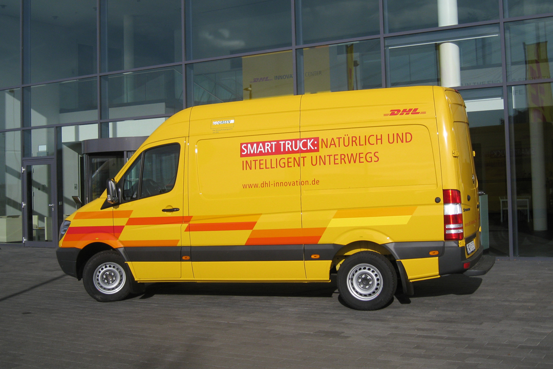
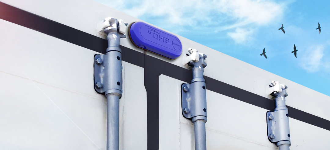
DHL SmartTruck: knows its cargo
More intelligent tour planning and smart use of RFID technology to give parcel recipients more reliable information about the scheduled delivery date. “DHL SmartTruck”, jointly developed by DLR and DHL Solutions & Innovation, is intended to make both delivery and picking up faster, more reliable and more transparent – from the standard parcel to container tracking.
© DPDHL Group
The idea: the current position not only of the delivery vehicle, but of every parcel should be known at any time. To this end, an RFID tag is affixed on every parcel storing the shipment ID. The delivery vehicle itself is equipped with RFID antennas. The SmartTruck knows which parcels it carries and sends their data jointly with its metre-precise position to a central server, where they can be retrieved by the shippers. The effect: recipients get a significantly more detailed information than just “shipment being delivered” and can much better organise their day accordingly. The SmartTruck technology has been tested by DHL in Germany and India. In 2018, DHL further developed the idea for the Indian market, where it offers temperature-controlled logistic solutions that can be tracked by the customer via app all over India.
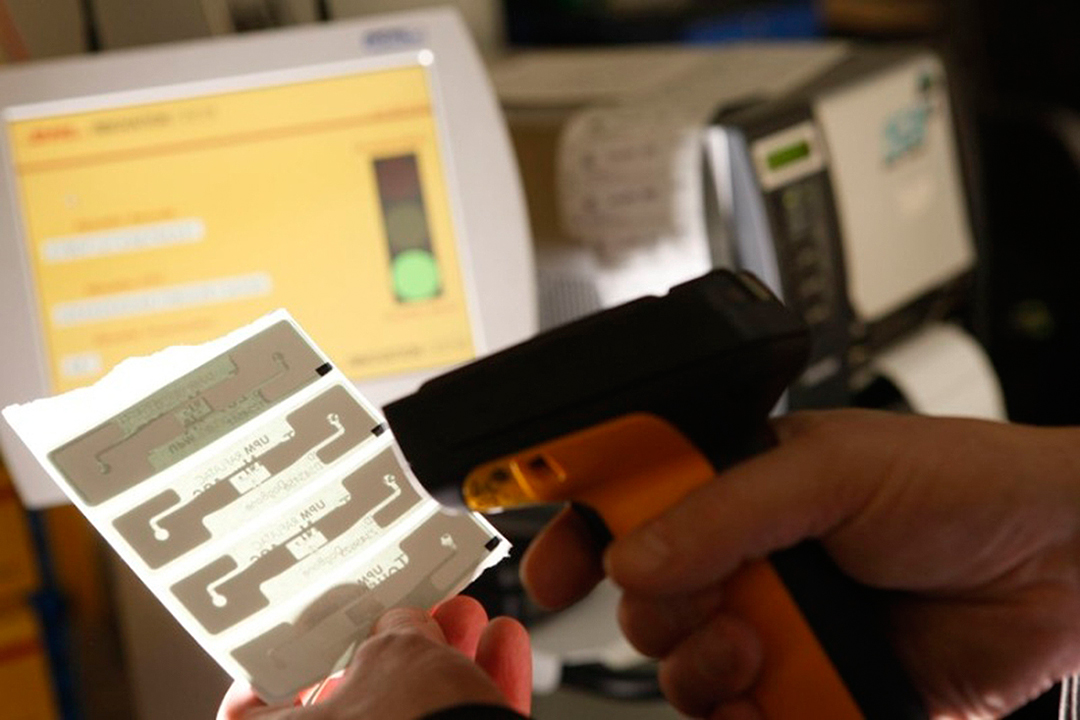
RFID tags give the “green light” once all parcels are on board.
© DPDHL Group
The radio stamp
RFID tracking of consignments of goods abroad has been possible since 2015: with adhesive radio tags. This service of Deutsche Post named “country proof“ enables customers to track the current location of the parcel – tracking is made contract-free by radio and not via barcode as in the case of normal parcels needing elaborate manual scanning.
The DLR on board the “SmartTruck”
In order to basically speed up delivery, the SmartTruck is equipped with
a novel tour planning software that navigates express delivery vehicles
past urban traffic jams. The delivery route is not planned statically at
the beginning of the tour but during the delivery tour, depending
on where traffic is currently running smoothly. The system deploys
“Floating Car Data“ (FCD) and has been developed by DLR scientists. In Berlin, for this purpose movement and traffic jam profiles of taxis are transmitted to a central server in real time. Stop-and-go traffic and the route of the “SmartTruck” can be derived from this data and the route of the “SmartTruck” is adjusted accordingly during transport. This saves about
15 per cent of the driving route, time, fuel, and money – thus decongesting the streets and relieving the strain on the environment.

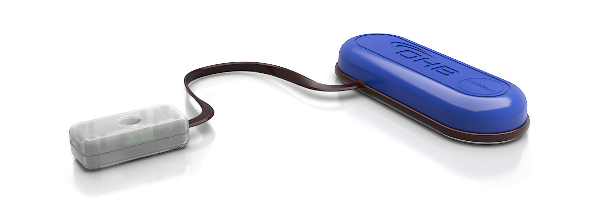
visioboxx: container tracking via satellite
© OHB SE
© OHB SE
How does a consignor or freight forwarder know whether sensitive cargo such as foodstuff or medicine is in impeccable condition upon arrival? The visioboxx of the Bremen space company OHB is the solution. Inside the container, sensors detect door opening, temperature, air humidity and vibrations. At the outside, the reception unit for Galileo and GPS is installed as well as the transmitter that transmits the data via mobile communications – and all that for considerably less than 100 euros. The data can be viewed live in an online portal. If a problem arises, one will immediately receive an alert e-mail. Interesting detail: the manufacturer OHB is also manufacturing Galileo satellites. visioboxx is based on the container tracking and monitoring system RTICM (Real Time Intelligent Cargo Monitoring) developed with support by ESA.
Development partners of the system are:
arviem (Switzerland)
LuxSpace Sàrl (Luxembourg)
OHB Teledata (Germany) and
megatel (Germany)
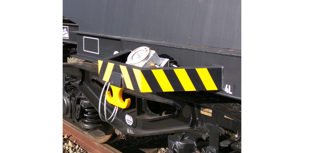
Tracking for hazardous material
cargo trains
© ESA
Based on ESA’s SaMoLoSa project, the Belgian company Ovinto is developing a special tracking system for the rail transport of hazardous materials. Besides monitoring of the status data of the cargo (e.g., temperature), the system also evaluates routes and makes suggestions for optimisation. The demands put on the hardware are very high since hazardous materials are often explosive.
Automatic alarm for hazmat accidents
In vehicles, the automatic emergency call system eCall is already installed and tracking solutions for hazardous materials are available as well. These two services will be networked in the future to ensure that in case of a hazmat accident – no matter whether truck, train, or compact van – the proper rescue forces or civil protection will be alerted straightaway. This saves precious time since the rescue workers know right from the emergency call that hazardous materials are on board. The ESA project DG-Trac is gaining experience in this respect.

Locating aircraft from space:
with “ADS-B over Satellite”
Aircraft can be located very well – from the ground. However, if there is no receiving station for the aircraft registration transmitter (Automatic Dependance Surveillance, ADS-B) within reach, or radar is not active in the region, the aircraft is “invisible”. This is particularly serious if an aircraft disappears on the high seas and the last position data available are very old. Where is the search supposed to begin? The solution for the location gap problem: ADS-B receivers in space, on satellites. This technology was tested for the first time by DLR researchers, and, in 2019, a global-scale system of the provider Aireon became operational.
© DLR
Since 2013, the ESA satellite PROBA-V has been in its 820-kilometre orbit – jointly
with a receiver for the ADS-B signals from aircraft. The research result: location works!
“ADS-B over Satellite” is a joint project of the DLR Institute of Space Systems and
the DLR Institute of Flight Guidance in cooperation with the Luxembourg partner
SES TechCom. It was funded by ESA, too. The idea was taken up by the commercial satellite operator Iridium. Since 2015, Iridium has been launching new communication satellites of the NEXT generation into space that carry an ADS-B receiver for Aireon on board, and the system has been ready for operation since February 2019. This means a revolution in air traffic since the ADS-B coverage is extended from 30 per cent of the Earth to 100 per cent. The gapless monitoring provides for a better and safer exploitation of the airspace. The groundwork for this was laid by the SALSA project (Satellite-based ADS-B for Lower Separation Minima), in which DLR is involved.